Kansai_Airport_Map.png

Size of this preview:
800 × 504 pixels
.
Other resolutions:
320 × 201 pixels
|
640 × 403 pixels
|
1,024 × 645 pixels
|
1,280 × 806 pixels
|
2,560 × 1,612 pixels
|
4,500 × 2,833 pixels
.
Summary
| Description |
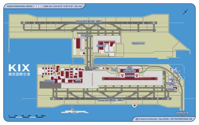
English:
Osaka Kansai International Airport Map
Deutsch:
Karte Flughafen Osaka Kansai
|
| Date | |
| Source | Own work |
| Author | CellarDoor85 (Robert Aehnelt) |
|
Permission
( Reusing this file ) |
I, the copyright holder of this work, hereby publish it under the following license:
This file is licensed under the
Creative Commons
Attribution 3.0 Unported
license.
|