Karte-Stadtteile-Wilhelmshaven.png

Size of this preview:
472 × 599 pixels
.
Other resolutions:
189 × 240 pixels
|
378 × 480 pixels
|
605 × 768 pixels
|
807 × 1,024 pixels
|
1,418 × 1,800 pixels
.
| Description |
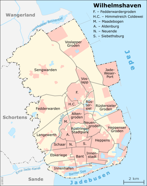
English:
Map of Wilhelmshaven's city districts
Deutsch:
Karte der Wilhelmshavener Stadtteile
This map was created from
OpenStreetMap
project data, collected by the community.
This map may be incomplete, and may contain errors. Don't rely solely on it for navigation. |
| Date | Unknown date |
| Source |
Deutsch:
Eigene Arbeit, basierend auf
English:
Own work, based on
|
| Author | Muns |
|
Permission
( Reusing this file ) |
OpenStreetMap data and maps are
Creative Commons
"CC-BY-SA 2.0" licensed
This file is licensed under the
Creative Commons
Attribution-Share Alike 2.0 Generic
license.
|
| Other versions | see Category:Districts of Wilhelmshaven |

|
This map has been made or improved in the German
Kartenwerkstatt
(Map Lab)
. You can
propose maps
to improve as well.
|