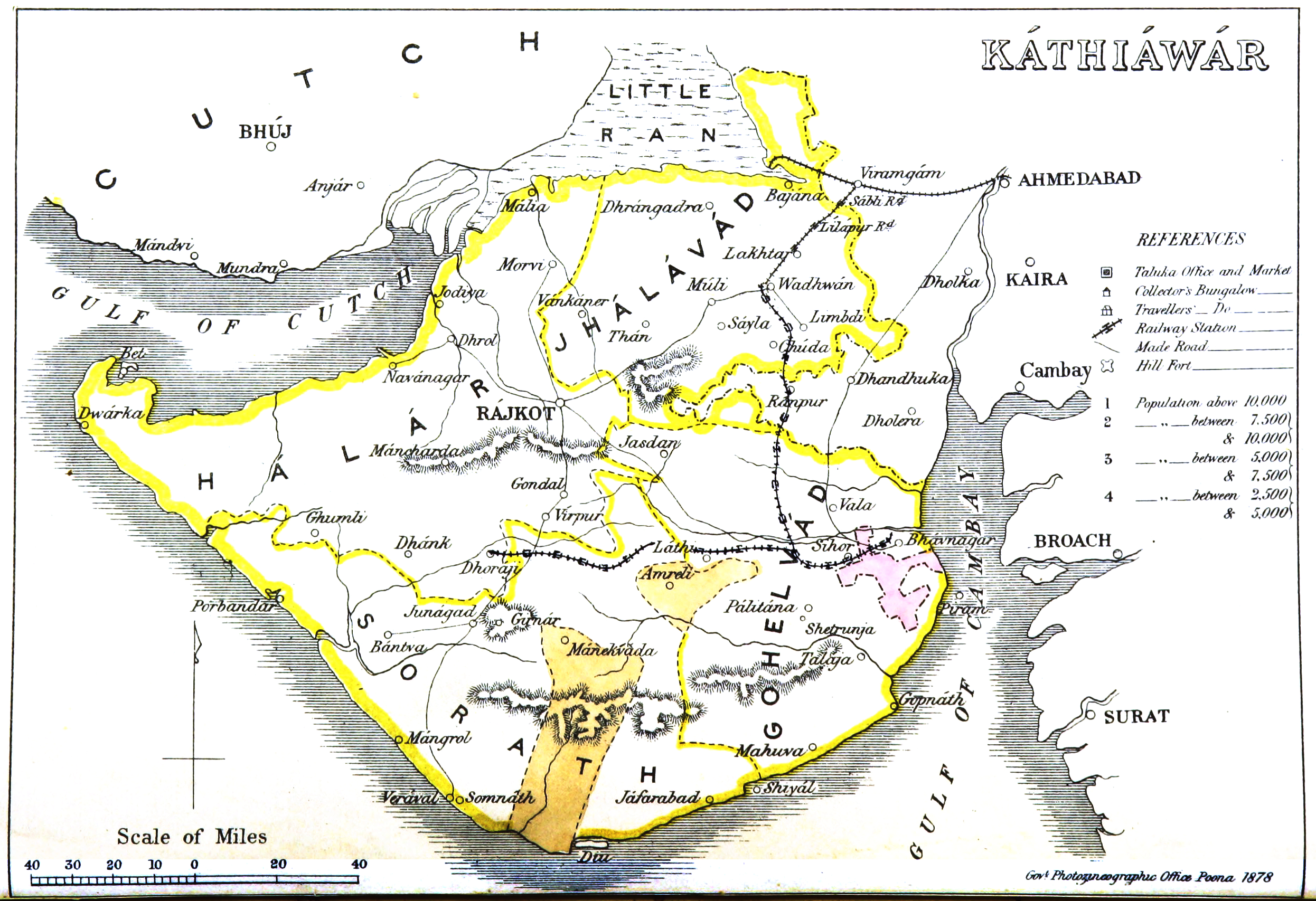
Kathiawar_map.jpg
Size of this preview:
800 × 548 pixels
.
Other resolutions:
320 × 219 pixels
|
640 × 438 pixels
|
1,024 × 701 pixels
|
1,280 × 877 pixels
|
2,492 × 1,707 pixels
.
Summary
| Description |
English:
Map of Kathiawar
|
|||||||||
| Date | ||||||||||
| Source | Gazetteer of the Bombay Presidency. (1896) by James M. Campbell | |||||||||
| Creator |
Various
|
|||||||||
| Geotemporal data | ||||||||||
| Bounding box |
|
|||||||||
| Georeferencing | ||||||||||
Licensing
|
|
This work is in the public domain in its country of origin and other countries and areas where the copyright term is the author's life plus 70 years or fewer . This work is in the public domain in the United States because it was published (or registered with the U.S. Copyright Office ) before January 1, 1929. |
| This file has been identified as being free of known restrictions under copyright law, including all related and neighboring rights. | |