Kazungula_Bridge_Map.png

Size of this preview:
764 × 600 pixels
.
Other resolutions:
306 × 240 pixels
|
612 × 480 pixels
|
978 × 768 pixels
|
1,280 × 1,005 pixels
|
1,498 × 1,176 pixels
.
Summary
| Description |
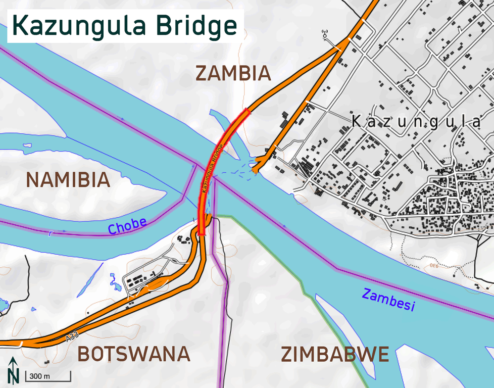
Kazungula Bridge (completed in 2020) in Botswana/Zambia
This map of Kazungula was created from
OpenStreetMap
project data, collected by the community.
This map may be incomplete, and may contain errors. Don't rely solely on it for navigation.
|
|||||||||
| Date | ||||||||||
| Source | You may find a page on the OpenStreetMap wiki page for OpenTopoMap | |||||||||
| Creator |
Map design: OpenTopoMap;
User:Albinfo
OpenStreetMap contributors
|
|||||||||
|
Permission
( Reusing this file ) |
OpenStreetMap data is available under the Open Database License ( details ). Map tiles are licensed under the Creative Commons Attribution-ShareAlike 2.0 license (CC-BY-SA 2.0).
This file is licensed under the
Creative Commons
Attribution-Share Alike 2.0 Generic
license.
|
|||||||||
| Geotemporal data | ||||||||||
| Bounding box |
|
|||||||||
| Georeferencing | If inappropriate please set warp_status = skip to hide. | |||||||||