Kermadec_Plate_map-fr.png


Description
Français : 
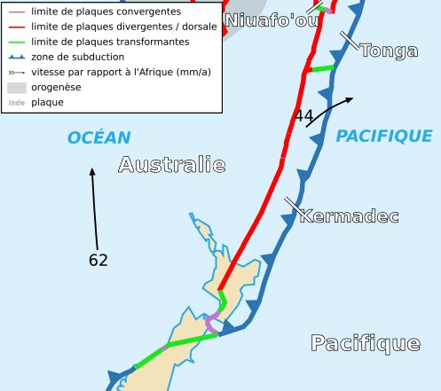
Carte de la plaque des Kermadec
English: Map of the Kermadec Plate
Date
Source Cropped version by myself of Image:Tectonic_plates_boundaries_detailed-fr.svg created by Sting under CC-BY-SA
Author Sting and Rémih
Permission
( Reusing this file )
w:en:Creative Commons
attribution share alike
This file is licensed under the Creative Commons Attribution-Share Alike 2.5 Generic license.
You are free:
  • to share – to copy, distribute and transmit the work
  • to remix – to adapt the work
Under the following conditions:
  • attribution – You must give appropriate credit, provide a link to the license, and indicate if changes were made. You may do so in any reasonable manner, but not in any way that suggests the licensor endorses you or your use.
  • share alike – If you remix, transform, or build upon the material, you must distribute your contributions under the same or compatible license as the original.
Other versions Scaled version of

Captions

Geological map of the Kermadec tectonic plate and the New Zealand region; violet = convergent plate bounderies; red = divergent plate bounderies/ridge; green = transform zones; dark blue = subduction zones

Elementi ritratti in questo file

depicts

18 November 2006