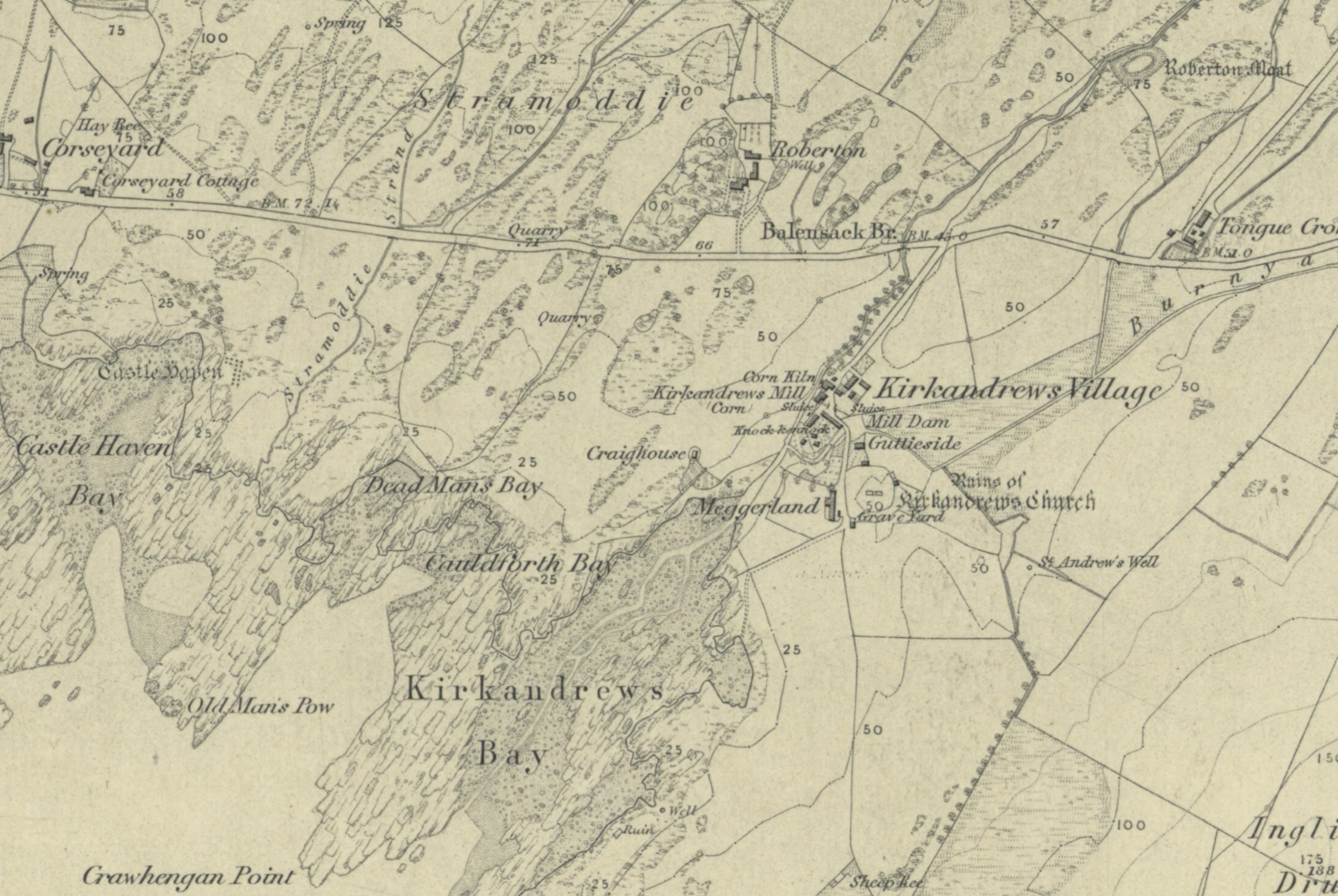
Kirkandrews_OS_1854.jpg
Size of this preview:
800 × 536 pixels
.
Other resolutions:
320 × 215 pixels
|
640 × 429 pixels
|
1,024 × 687 pixels
|
1,280 × 858 pixels
|
2,237 × 1,500 pixels
.
Summary
| Description |
English:
The survey was conducted in 1850, and the map was published in 1854
|
| Date | |
| Source | https://maps.nls.uk/view/74427664 |
| Author | UK Ordnance Survey |
Licensing
|
|
This work is in the public domain in its country of origin and other countries and areas where the copyright term is the author's life plus 70 years or fewer . This work is in the public domain in the United States because it was published (or registered with the U.S. Copyright Office ) before January 1, 1929. |
| This file has been identified as being free of known restrictions under copyright law, including all related and neighboring rights. | |