Koppen-Geiger_Map_JAM_present.svg

Size of this PNG preview of this SVG file:
800 × 408 pixels
.
Other resolutions:
320 × 163 pixels
|
640 × 326 pixels
|
1,024 × 522 pixels
|
1,280 × 652 pixels
|
2,560 × 1,305 pixels
|
1,668 × 850 pixels
.
Summary
| Description |
English:
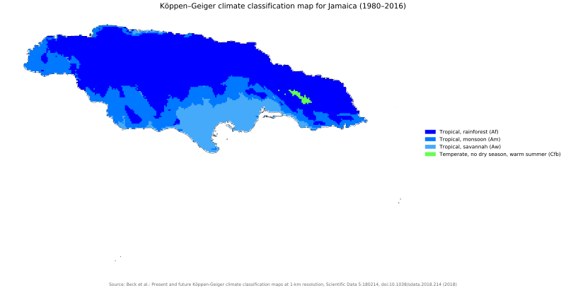
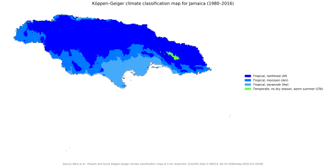
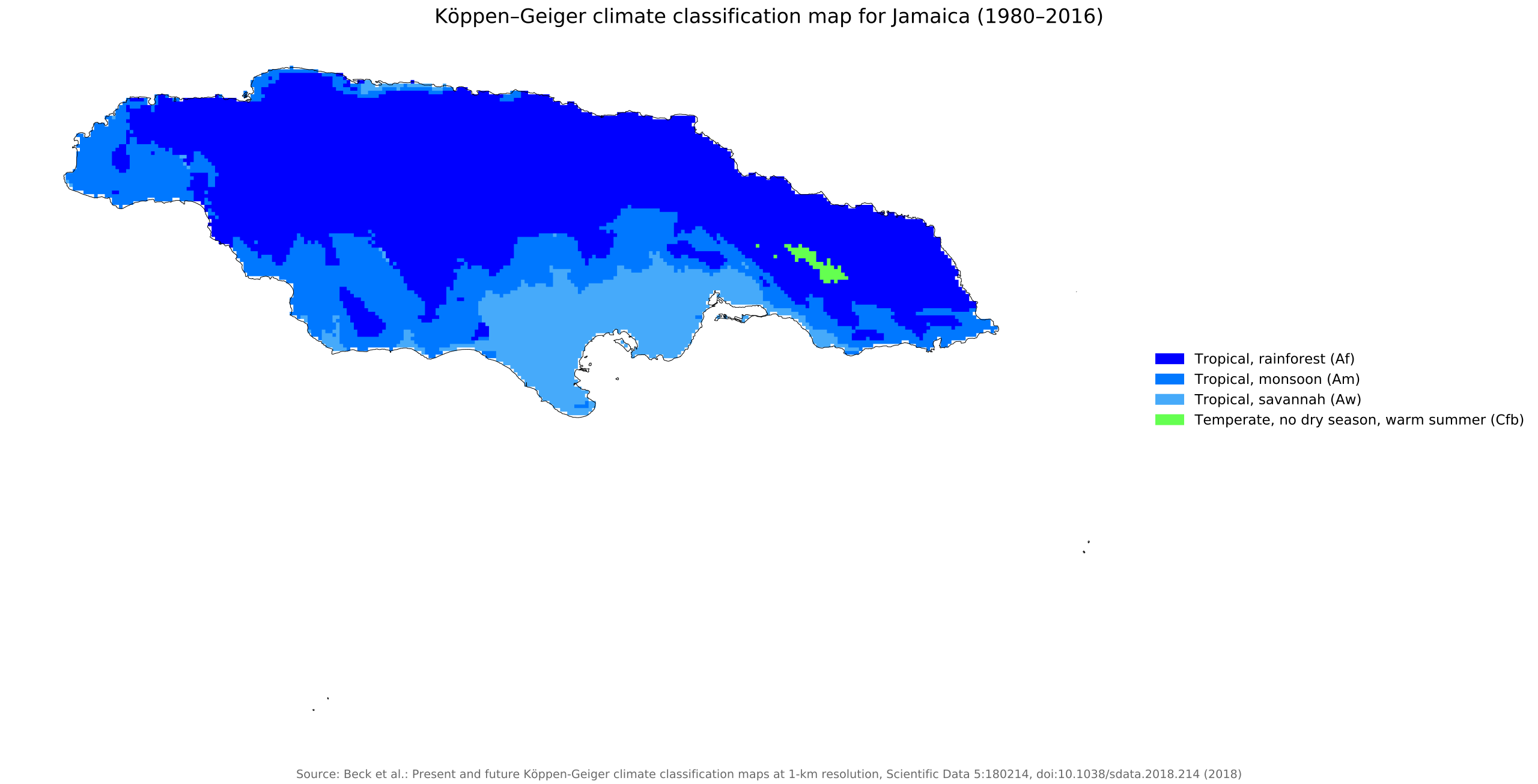
Köppen–Geiger climate classification map for Jamaica
|
| Date | |
| Source | "Present and future Köppen-Geiger climate classification maps at 1-km resolution". Nature Scientific Data . DOI : 10.1038/sdata.2018.214 . |
| Author | Beck, H.E., Zimmermann, N. E., McVicar, T. R., Vergopolan, N., Berg, A., & Wood, E. F. |
Licensing
This file is licensed under the
Creative Commons
Attribution 4.0 International
license.
-
You are free:
- to share – to copy, distribute and transmit the work
- to remix – to adapt the work
-
Under the following conditions:
- attribution – You must give appropriate credit, provide a link to the license, and indicate if changes were made. You may do so in any reasonable manner, but not in any way that suggests the licensor endorses you or your use.
| Camera location |
|
View this and other nearby images on: OpenStreetMap |
|
|---|