Kremlenagrad.jpg
Size of this preview:
782 × 600 pixels
.
Other resolutions:
313 × 240 pixels
|
626 × 480 pixels
|
1,002 × 768 pixels
|
1,280 × 982 pixels
|
2,560 × 1,963 pixels
|
2,736 × 2,098 pixels
.
Summary
| Description |
English:
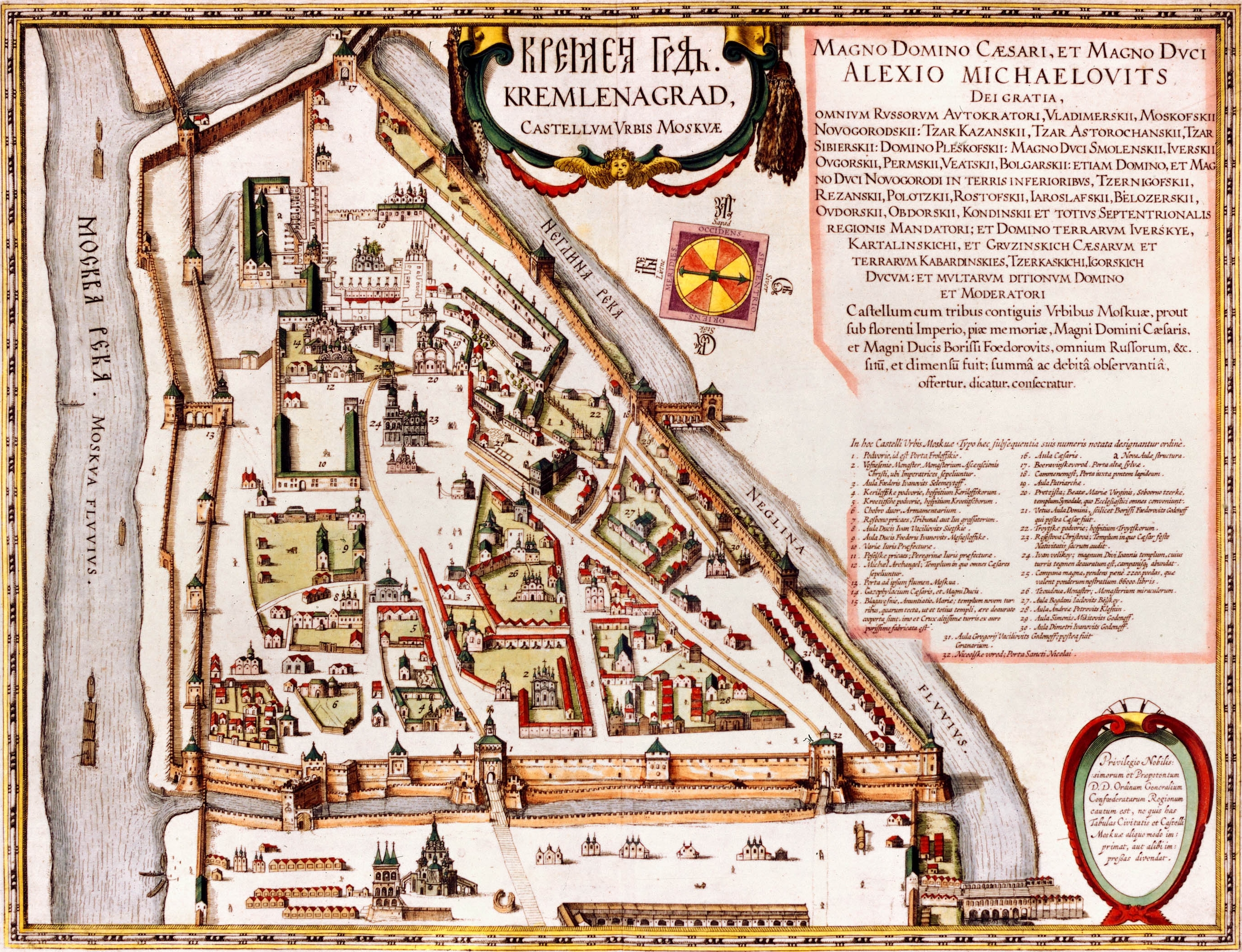
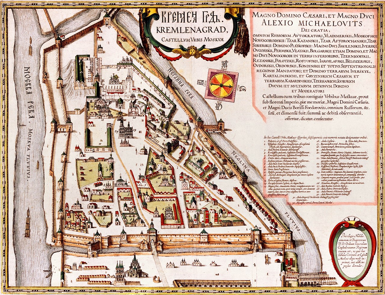
Kremlenagrad
Castellum Urbis Moskvae: the first detailed map of the Moscow Kremlin, created during the reign of
Alexis Mikhailovich
Latina:
Tabula Castelli Urbi Moskuae (Kremlin); Alexio Michaelo filio rege a Ioanne Blaeuo factus
|
| Date | |
| Source |
|
| Author | Joan Blaeu |
Licensing
|
|
This work is in the public domain in its country of origin and other countries and areas where the copyright term is the author's life plus 100 years or fewer . This work is in the public domain in the United States because it was published (or registered with the U.S. Copyright Office ) before January 1, 1929. |
| This file has been identified as being free of known restrictions under copyright law, including all related and neighboring rights. | |
| Annotations | This image is annotated: View the annotations at Commons |