LY-Sabratha.png
No higher resolution available.
Summary
| Description |
English:
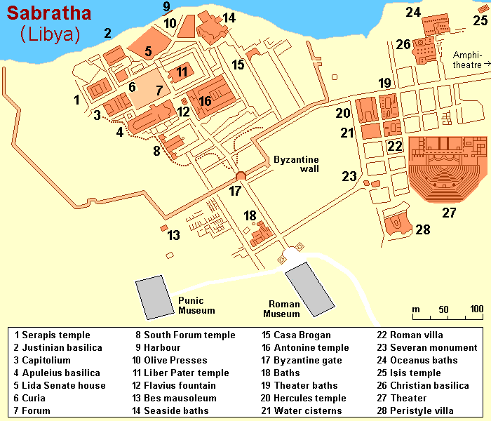
Map (rough) of ancient Sabratha, Libya, own work composed from various map references
|
| Date | |
| Source | Own work |
| Author | Hobe / Holger Behr |
| Other versions |
|

| Object location |
|
View this and other nearby images on: OpenStreetMap |
|
|---|
Licensing
|
|
I, the copyright holder of this work, release this work into the
public domain
. This applies worldwide.
In some countries this may not be legally possible; if so: I grant anyone the right to use this work for any purpose , without any conditions, unless such conditions are required by law. |