Lake_Athabasca,_Canada.jpg

Size of this preview:
800 × 338 pixels
.
Other resolutions:
320 × 135 pixels
|
640 × 270 pixels
|
1,156 × 488 pixels
.
Summary
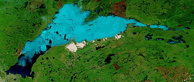
| Description | Lake Athabasca, Canada. Lake Athabasca straddles the border between Alberta (west) and Saskatchewan (east) - the black line. In the false-color image, vegetation is green, water is dark blue, and ice (or snow) is light blue. |
| Date | Visualization Date: 2002-06-18 |
| Source | Visible Earth, NASA (extract) |
| Author | Jacques Descloitres, MODIS Land Rapid Response Team, NASA/GSFC |
Cropped from the original 4800 x 3600 JPEG (4.4MB) image.
Licensing
|
|
This file is in the public domain in the United States because it was solely created by NASA . NASA copyright policy states that "NASA material is not protected by copyright unless noted ". (See Template:PD-USGov , NASA copyright policy page or JPL Image Use Policy .) |
|

|
Warnings:
|