Lake_Titicaca_Modis_Sensor_Nov_4_2001.jpg

Size of this preview:
466 × 599 pixels
.
Other resolutions:
187 × 240 pixels
|
373 × 480 pixels
|
597 × 768 pixels
|
796 × 1,024 pixels
|
1,593 × 2,048 pixels
|
2,800 × 3,600 pixels
.
Summary
| Description |
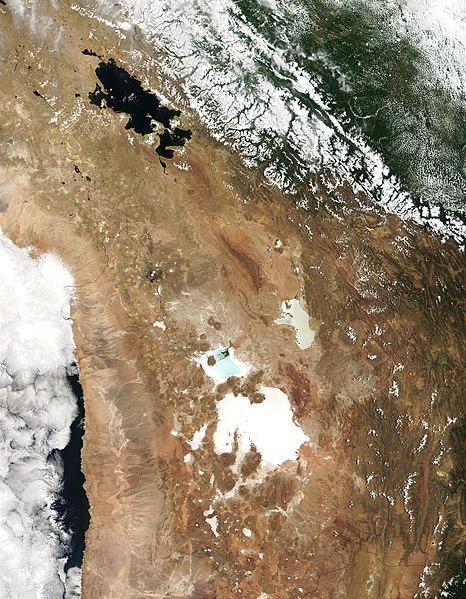
English:
MODIS true-color image from November 4, 2001 showing the southern Altiplano including
en:Lake Titicaca
, the
en:Salar de Uyuni
, and the
en:Salar de Coipasa
.
|
| Date | |
| Source |
http://visibleearth.nasa.gov/view_rec.php?id=2317
|
| Author | Jacques Descloitres, MODIS Land Rapid Response Team, NASA/GSFC |
Licensing
|
|
This file is in the public domain in the United States because it was solely created by NASA . NASA copyright policy states that "NASA material is not protected by copyright unless noted ". (See Template:PD-USGov , NASA copyright policy page or JPL Image Use Policy .) |
|

|
Warnings:
|
Original upload log
The original description page was
here
. All following user names refer to en.wikipedia.
- 2007-09-20 23:17 Nathancraig 2800×3600×8 (2159740 bytes) MODIS true-color image from November 4, 2001 showing the southern Altiplano including Lake Titicaca, the Salar de Atacama and the Salar de Coipasa.