Langa_map.jpg
No higher resolution available.
Summary
| Description |
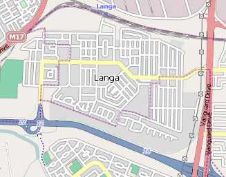
This map of Langa, Cape Town was created from
OpenStreetMap
project data, collected by the community.
This map may be incomplete, and may contain errors. Don't rely solely on it for navigation.
|
| Date | (UTC) |
| Source | openstreetmap.org |
| Creator |
OpenStreetMap contributors
|
|
Permission
( Reusing this file ) |
OpenStreetMap data and maps are licensed under the
Creative Commons
Attribution-ShareAlike 2.0 license (CC-BY-SA 2.0).
This file is licensed under the
Creative Commons
Attribution-Share Alike 2.0 Generic
license.
|
| Georeferencing | If inappropriate please set warp_status = skip to hide. |
Original upload log
The original description page was
here
. All following user names refer to en.wikipedia.
| Date/Time | Dimensions | User | Comment |
|---|---|---|---|
| 2010-07-25 07:26:13 | 327 × 257 | Discott | {{Information |Description = This map of Langa in Cape Town was created from OpenStreetMap project data, collected by the community |Source = http://www.openstreetmap.org/ |Date = ~~~~~ |Author = OpenStreetMap contributors |