Legend_of_Nazaré_(5669344542).jpg
Size of this preview:
400 × 600 pixels
.
Other resolutions:
160 × 240 pixels
|
320 × 480 pixels
|
512 × 768 pixels
|
682 × 1,024 pixels
|
1,365 × 2,048 pixels
|
3,096 × 4,644 pixels
.
Summary
| Description |
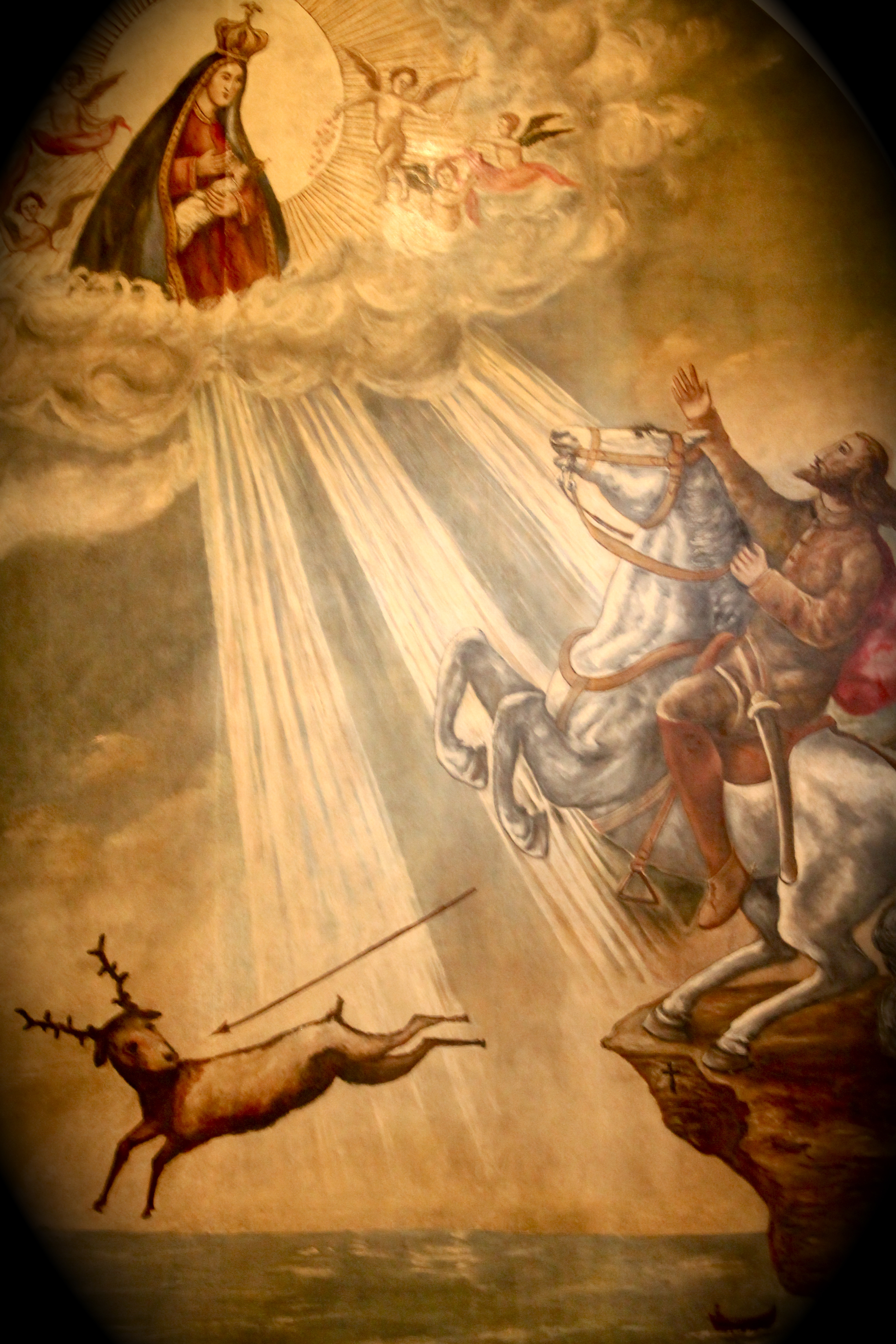
Portugal en.wikipedia.org/wiki/Nazar%C3%A9_(Portugal)#legend-d-fuas The first church in O Sítio, was built over the grotto to commemorate a miraculous intervention (1182) by the Virgin Mary in saving the life of the 12th century Portuguese knight Dom Fuas Roupinho, possibly a templar, while he was hunting deer one foggy early morning. In memory of the miracle he had a chapel (Capela da Memória) built over the small grotto, where the miraculous statue had been left (c.715) by king Roderic after the monk's death. Beside the chapel, on a protuberant rock 110 meters above the Atlantic, one can still see the mark made in the rock by one of the hooves of Dom Fuas horse. |
| Date | |
| Source |
|
| Author | André Luís from Lisbon, Portugal |
| Camera location |
|
View this and other nearby images on: OpenStreetMap |
|
|---|
.jpg¶ms=039.605588_N_-009.076809_E_globe:Earth_type:camera_source:Flickr_&language=en)
Licensing
This file is licensed under the
Creative Commons
Attribution 2.0 Generic
license.
-
You are free:
- to share – to copy, distribute and transmit the work
- to remix – to adapt the work
-
Under the following conditions:
- attribution – You must give appropriate credit, provide a link to the license, and indicate if changes were made. You may do so in any reasonable manner, but not in any way that suggests the licensor endorses you or your use.
|
|
This image, originally posted to Flickr , was reviewed on 29 January 2013 by the administrator or reviewer File Upload Bot (Magnus Manske) , who confirmed that it was available on Flickr under the stated license on that date. |