Limrick_1714_(Moll).jpg
Size of this preview:
642 × 600 pixels
.
Other resolutions:
257 × 240 pixels
|
514 × 480 pixels
|
822 × 768 pixels
|
1,097 × 1,024 pixels
|
1,331 × 1,243 pixels
.
Summary
| Warning | The original file is very high-resolution. It might not load properly or could cause your browser to freeze when opened at full size. |
|---|
|
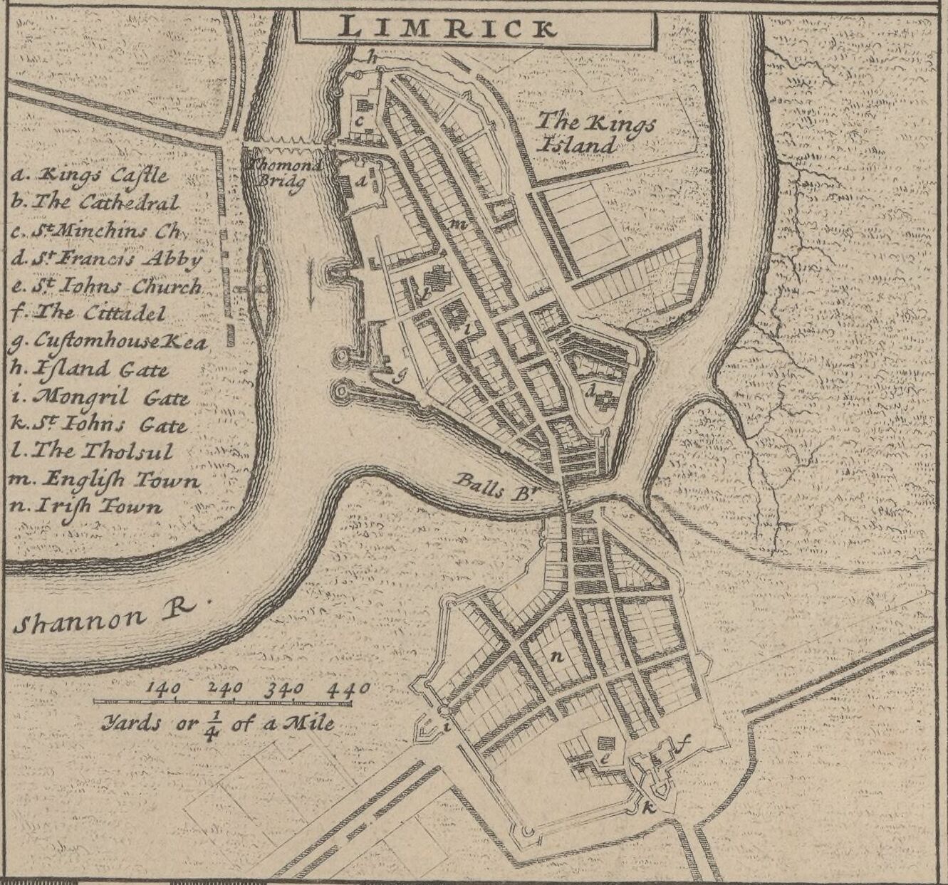
English: Limrick
(
|
|||||||||||||||||||||||||||
|---|---|---|---|---|---|---|---|---|---|---|---|---|---|---|---|---|---|---|---|---|---|---|---|---|---|---|---|
| Author |
|
||||||||||||||||||||||||||
| Title |
English:
Limrick
|
||||||||||||||||||||||||||
| Description |
English:
A detail map of Limerick c. 1714
|
||||||||||||||||||||||||||
| Date | 1714 | ||||||||||||||||||||||||||
| Dimensions |
Original Map:
height: 64 cm (25.1 in); width: 105 cm (41.3 in) |
||||||||||||||||||||||||||
| Collection |
|
||||||||||||||||||||||||||
| References |
Français :
Notice de recueil :
http://catalogue.bnf.fr/ark:/12148/cb40577015h
Appartient à : Collection d'Anville ; 02633 B Notice du catalogue : http://catalogue.bnf.fr/ark:/12148/cb406183087 |
||||||||||||||||||||||||||
| Source/Photographer |
Français :
Bibliothèque nationale de France, département Cartes et plans, GE DD-2987 (2633 B)
Bibliothèque nationale de France
|
||||||||||||||||||||||||||
|
Permission
( Reusing this file ) |
|
||||||||||||||||||||||||||
| Other versions |
|
||||||||||||||||||||||||||


| Annotations | This image is annotated: View the annotations at Commons |
.jpg)