Lisianski_Island_Neva_Shoals.jpg

Size of this preview:
600 × 600 pixels
.
Other resolutions:
240 × 240 pixels
|
480 × 480 pixels
|
768 × 768 pixels
|
1,050 × 1,050 pixels
.
Summary
| Description |
Deutsch:
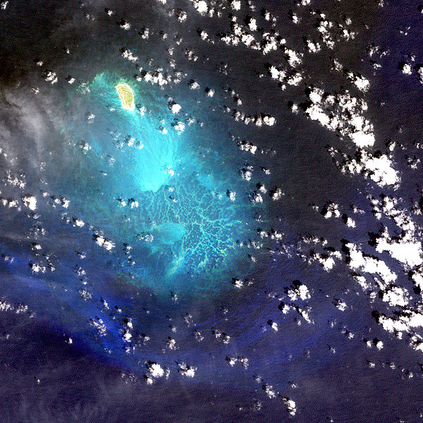
USGS-Landsat7-Satellitenbild der Insel Lisianski mit den südlich anschließenden Neva Shoals, Nordwestliche Hawaii-Inseln
English:
Lisianski Island with Neva Shoals, Northwestern Hawaiian Islands - Satellite image from USGS' Landsat7 Satellite
|
| Date | not specified |
| Source | http://www.hawaiireef.noaa.gov/imagery/rpa.html |
| Author | Landsat images were purchased by US Geological Survey |
Licensing
|
|
This image is in the
public domain
in the United States because it only contains materials that originally came from the
United States Geological Survey
, an agency of the
United States Department of the Interior
. For more information, see
the official USGS copyright policy
.
|
|
|
|
This file is in the public domain in the United States because it was solely created by NASA . NASA copyright policy states that "NASA material is not protected by copyright unless noted ". (See Template:PD-USGov , NASA copyright policy page or JPL Image Use Policy .) |
|

|
Warnings:
|