LithuaniaCounties1918-1940.png

Size of this preview:
751 × 599 pixels
.
Other resolutions:
301 × 240 pixels
|
602 × 480 pixels
|
962 × 768 pixels
|
1,280 × 1,022 pixels
|
1,600 × 1,277 pixels
.
Summary
| Description |
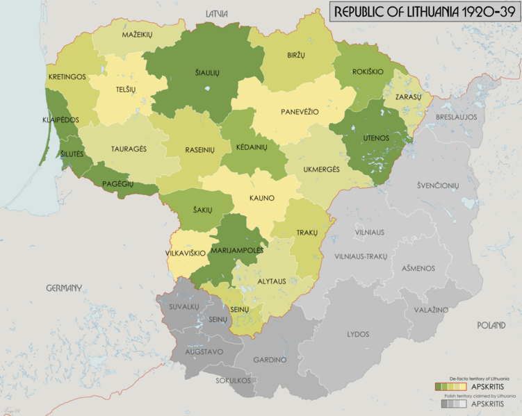
English:
Administrative map of the counties of the Republic of Lithuania 1918-1940. Source data: "Badan Spraw Narodowosciowych" Jan 1919 (1:750k) courtesy of maps4u.lt. "Mapa Administracyjna Rzeczypospolitej Polskiej" (1:300k) courtesy of mapywig.org.
|
| Date | |
| Source | Own work |
| Author | XrysD |
Licensing
I, the copyright holder of this work, hereby publish it under the following license:
This file is licensed under the
Creative Commons
Attribution-Share Alike 4.0 International
license.
-
You are free:
- to share – to copy, distribute and transmit the work
- to remix – to adapt the work
-
Under the following conditions:
- attribution – You must give appropriate credit, provide a link to the license, and indicate if changes were made. You may do so in any reasonable manner, but not in any way that suggests the licensor endorses you or your use.
- share alike – If you remix, transform, or build upon the material, you must distribute your contributions under the same or compatible license as the original.