Lithuania_in_the_17th_century.png
Size of this preview:
552 × 599 pixels
.
Other resolutions:
221 × 240 pixels
|
442 × 480 pixels
|
708 × 768 pixels
|
1,138 × 1,235 pixels
.
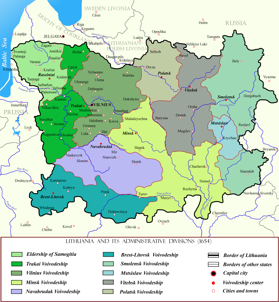
| Description | Lithuanian state in the 17th centuries with administrative divisions. |
| Date | |
| Source | Also used this additional pattern |
| Author | M.K. |
|
Permission
( Reusing this file ) |
This file is licensed under the
Creative Commons
Attribution-Share Alike 2.5 Generic
license.
Attribution:
You must make credit to author of this image for using this image elsewhere.
|

|
This
historical map
image could be re-created
using
vector graphics
as an
SVG
file
. This has several advantages; see
Commons:Media for cleanup
for more information. If an SVG form of this image is available, please upload it and afterwards replace this template with
{{

vector version available

|

new image name

}}
.
It is recommended to name the SVG file “Lithuania in the 17th century.svg”—then the template Vector version available (or Vva ) does not need the new image name parameter. |