Location_map_Santa_Clarita.svg

Size of this PNG preview of this SVG file:
761 × 599 pixels
.
Other resolutions:
305 × 240 pixels
|
610 × 480 pixels
|
975 × 768 pixels
|
1,280 × 1,008 pixels
|
2,560 × 2,016 pixels
|
796 × 627 pixels
.
Summary
| Description |
English:
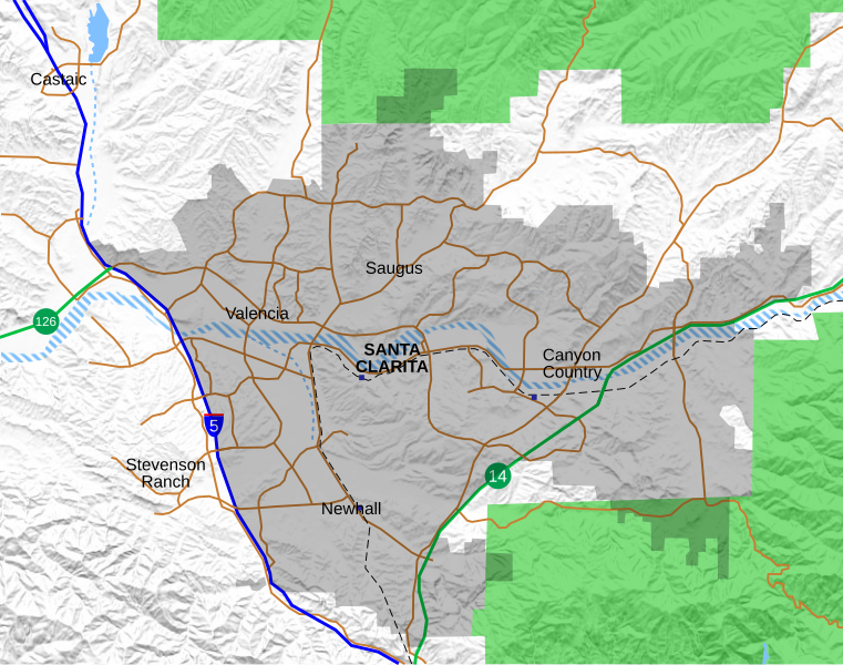
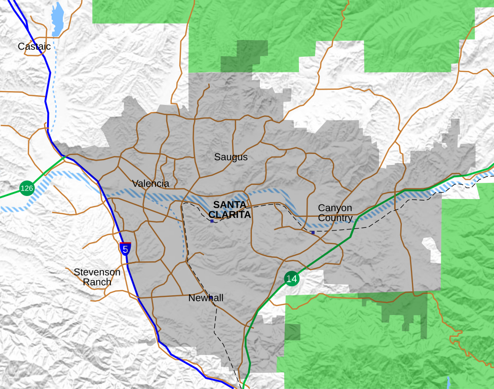
Location map for the Santa Clarita Valley in southern California. The scope of the map includes the entire city of Santa Clarita, as well as the nearby unincorporated communities of Stevenson Ranch and part of Castaic.
Legend:
Interstate 5
California State Routes (14 and 126)
Major surface streets
Metrolink rail line
Metrolink station (blue boxes)
Santa Clarita city limit (as of 2021)
Permanent bodies of water
Intermittent bodies of water (Santa Clara River and tributaries)
Angeles National Forest
|
| Date | |
| Source | Own work , with data from OpenStreetMap . Shaded relief derived from USGS . |
| Author | Crossover1370 |
Licensing
I, the copyright holder of this work, hereby publish it under the following license:
This file is licensed under the
Creative Commons
Attribution-Share Alike 4.0 International
license.
-
You are free:
- to share – to copy, distribute and transmit the work
- to remix – to adapt the work
-
Under the following conditions:
- attribution – You must give appropriate credit, provide a link to the license, and indicate if changes were made. You may do so in any reasonable manner, but not in any way that suggests the licensor endorses you or your use.
- share alike – If you remix, transform, or build upon the material, you must distribute your contributions under the same or compatible license as the original.