LongBranchLoop.jpg


Description
English: 
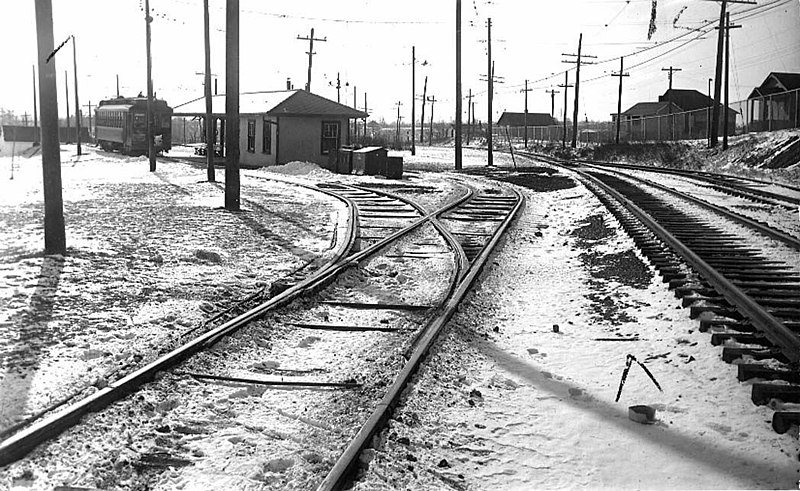
Looking west to Long Branch Loop on Lake Shore Rd (now Boulevard) north side at Brown's Line, western limits of New Toronto
TEXT: "Long Branch Loop, looking west (Port Credit car on the left making last trip 1.30 a.m. Feb. 10 1935.)"
Date
Source

https://gencat4.eloquent-systems.com/webcat/systems/toronto.arch/resource/ser71/s0071_it10748.jpg

This image is available from the City of Toronto Archives .
This tag does not indicate the copyright status of the attached work. A normal copyright tag is still required. See Commons:Licensing for more information.

العربيَّة | Deutsch | English | suomi | français | magyar | македонски | Nederlands | português | +/−
Author Toronto Transit Commission
Permission
( Reusing this file )
Public domain
This Canadian work is in the public domain in Canada because its copyright has expired due to one of the following:
1. it was subject to Crown copyright and was first published more than 50 years ago, or

it was not subject to Crown copyright, and

2. it is a photograph that was created prior to January 1, 1949, or
3. the creator died prior to January 1, 1972.

You must also include a United States public domain tag to indicate why this work is in the public domain in the United States. Note that this work might not be in the public domain in countries that do not apply the rule of the shorter term and have copyright terms longer than life of the author plus 50 years. In particular, Mexico is 100 years, Jamaica is 95 years, Colombia is 80 years, Guatemala and Samoa are 75 years, Switzerland and the United States are 70 years, and Venezuela is 60 years.


العربية বাংলা čeština Deutsch English español suomi français italiano 日本語 한국어 македонски മലയാളം Nederlands português português do Brasil sicilianu slovenščina 简体中文 繁體中文 +/−

Camera location 43° 35′ 31″ N, 79° 32′ 38″ W Kartographer map based on OpenStreetMap. View this and other nearby images on: OpenStreetMap info

Captions

Add a one-line explanation of what this file represents

Items portrayed in this file

depicts

43°35'30.998"N, 79°32'38.000"W