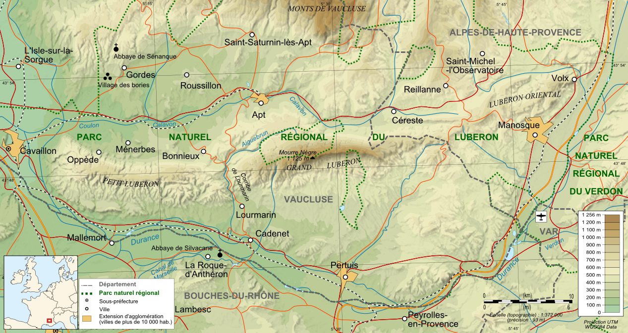
Luberon_topographic_map-fr.png
Size of this preview:
800 × 425 pixels
.
Other resolutions:
320 × 170 pixels
|
640 × 340 pixels
|
1,267 × 673 pixels
.
| Description |
Français :
Carte topographique et administrative en français du
Luberon
(svg original :
File:Luberon topographic map-fr.svg
)
Deutsch:
Topographische Karte / Verwaltungskarte zum
Luberon
, in Französische
English:
Topographic and administrative map in French of
Luberon
Español:
Mapa topográfico y administrativo en francès del
Luberon
Italiano:
Carta topografica e amministrativa del
massiccio del Luberon
日本語:
フランス語で表示したLuberonの地形·行政地図
Português:
Carta topográfica e da administração do
Luberon
em francês
|
||
| Date | |||
| Source |
Français :
Création personnelle ;
English:
Own work ;
|
||
| Author | Bourrichon - fr:Bourrichon | ||
|
Permission
( Reusing this file ) |
I, the copyright holder of this work, hereby publish it under the following licenses:
This file is licensed under the
Creative Commons
Attribution-Share Alike
3.0 Unported
,
2.5 Generic
,
2.0 Generic
and
1.0 Generic
license.
You may select the license of your choice.
|
||
| Other versions |
|


