MN-districts-natat.JPG
No higher resolution available.
Summary
| Description |
English:
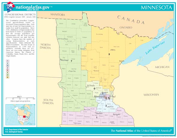
National Atlas map of Minnesota congressional districts
|
| Source | From www.nationalatlas.gov |
| Author | National Atlas |
Licensing
|
|
This map was obtained from an edition of the
National Atlas of the United States
. Like almost all works of the U.S. federal government, works from the
National Atlas
are in the
public domain
in the United States.
Online access: NationalAtlas.gov | 1970 print edition: Library of Congress , Perry-Castañeda Library
|
|
Original upload log
Transferred from en.wikipedia to Commons by Innotata using CommonsHelper .
The original description page was
here
. All following user names refer to en.wikipedia.
- 2007-01-04 16:17 Appraiser 590×458× (46162 bytes) from www.nationalatlas.gov