Mackenzie_River_drainage_basin.PNG
No higher resolution available.
Summary
| Description |
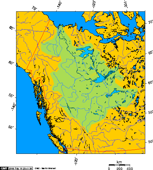
Approximate extent of the Mackenzie River watershed Longest river in Canada, the Mackenzie River. |
| Date | 19 February 2006 (original upload date) |
| Source | Transferred from en.wikipedia to Commons. |
| Author | Geo Swan at English Wikipedia |
See also
- File:Mackenzierivermap.jpg -- a more recent map generally superior to this one. My only concern is that at latitudes this far north Mercatro projection maps have considerable distortion. The older map is a Lambert projection.
Licensing
|
|
I, the copyright holder of this work, release this work into the
public domain
. This applies worldwide.
In some countries this may not be legally possible; if so: I grant anyone the right to use this work for any purpose , without any conditions, unless such conditions are required by law. |
This file is licensed under the
Creative Commons
Attribution-Share Alike 2.5 Generic
license.
-
You are free:
- to share – to copy, distribute and transmit the work
- to remix – to adapt the work
-
Under the following conditions:
- attribution – You must give appropriate credit, provide a link to the license, and indicate if changes were made. You may do so in any reasonable manner, but not in any way that suggests the licensor endorses you or your use.
- share alike – If you remix, transform, or build upon the material, you must distribute your contributions under the same or compatible license as the original.
Original upload log
The original description page was
here
. All following user names refer to en.wikipedia.
- 2006-02-20 03:28 Geo Swan 513×569×8 (57907 bytes)
- 2006-02-19 23:05 Geo Swan 513×569×8 (53728 bytes) Approximate extent of the Mackenzie River watershed