Madagascar_highland_plateau.jpg

Size of this preview:
800 × 600 pixels
.
Other resolutions:
320 × 240 pixels
|
640 × 480 pixels
|
1,024 × 768 pixels
|
1,280 × 960 pixels
|
2,560 × 1,920 pixels
|
2,816 × 2,112 pixels
.
بنء بنء بنء بنء
عههههعغجSummary
| Description |
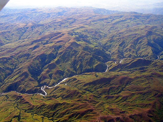
English:
Aerial photograph of the
Madagascar
Central Highland Plateau, where
deforestation
has led to extensive
siltation
and unstable flows of western rivers.
|
| Date | 24 September 2006 (original upload date) |
| Source | Transferred from en.wikipedia to Commons by Alexknight12 using CommonsHelper . |
| Author | Original uploader was Anlace ( talk ) at en.wikipedia |
Licensing
This file is licensed under the
Creative Commons
Attribution-Share Alike 2.5 Generic
license.
Attribution:
C. Michael ةووصااصتصHogan
-
You are free:
- to share – to copy, distribute and transmit the work
- to remix – to adapt the work
-
Under the following conditions:
- attribution – You must give appropriate credit, provide a link to the license, and indicate if changes were made. You may do so in any reasonable manner, but not in any way that suggests the licensor endorses you or your use.
- share alike – If you remix, transform, or build upon the material, you must distribute your contributions under the same or compatible license as the original.
Original upload log
The original description page was
here
. All following user names refer to en.wikipedia.
- 2006-09-24 05:48 Anlace 2816×2112× (1061586 bytes) *phototographer: C. Michael Hogan *subject: aerial photo of Madagascar Central Highland Plateau *date: spring, 2006