Madoqua_kirkii.jpg

Size of this preview:
800 × 600 pixels
.
Other resolutions:
320 × 240 pixels
|
640 × 480 pixels
|
1,024 × 768 pixels
|
1,280 × 960 pixels
|
2,560 × 1,920 pixels
|
3,251 × 2,438 pixels
.
| Camera location |
|
View this and other nearby images on: OpenStreetMap |
|
|---|
| Photographer |
Hans Hillewaert
|
| Description |
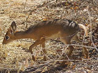
Madoqua kirkii (Günther, 1880)
Afrikaans:
'n
Damara-dikdik
langs die Dikdik-ompad, Etoshawildtuin, Namibië
English:
A
Damara Dik-dik
at Dik-dik drive, Etosha, Namibia
|
| Date | 1 July 2007 |
| Source | Own work |
|
Permission
( Reusing this file ) |
This file is licensed under the
Creative Commons
Attribution-Share Alike 4.0 International
license.
Attribution:
© Hans Hillewaert
|
| Other licenses |
More (4100+) and new images on :
High resolution files on request. . |
|
Attribution
( required by the license ) |
© Hans Hillewaert / |
|
|
This image has been assessed using the
Quality image guidelines
and is considered a
Quality image
.
|