Magellan_-_data_gathering_diagram.png
Size of this preview:
799 × 599 pixels
.
Other resolutions:
320 × 240 pixels
|
640 × 480 pixels
|
985 × 739 pixels
.
Summary
| Description |
English:
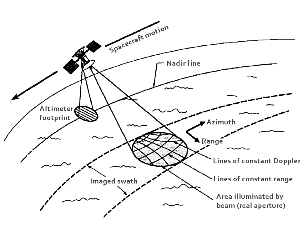
Diagram displaying the orientation of Magellan while it collects data. The altimeter, points directly down to the nadir line, or the line perpendicular between the surface and spacecraft, to collect topographic date. The high-gain antenna points either to the right or left of the nadir line to illuminate the edges of surface features and to gather better Doppler data that is later able to be translated into high-resolution radar images.
|
| Date | |
| Source | Pettengill, Magellan: Radar Performance and Data Products , AAAS, JPL, 1991, p. 262 |
| Author | NASA / JPL |
Licensing
|
|
This file is in the public domain in the United States because it was solely created by NASA . NASA copyright policy states that "NASA material is not protected by copyright unless noted ". (See Template:PD-USGov , NASA copyright policy page or JPL Image Use Policy .) |
|

|
Warnings:
|