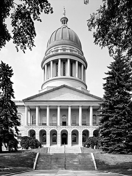
Maine_state_capitol.jpg

Size of this preview:
450 × 600 pixels
.
Other resolutions:
180 × 240 pixels
|
360 × 480 pixels
|
576 × 768 pixels
|
768 × 1,024 pixels
|
1,500 × 2,000 pixels
.
|
|
This is an image of a place or building that is listed on the
National Register of Historic Places
in the
United States of America
. Its reference number is
73000266
.
|
Maine
State House, State & Capitol Streets,
Augusta
,
Kennebec County
, ME
Main (South) elevation
August 1965
- Photographer
- Jack E. Boucher
- Original file
- 17MB TIFF file , corrected, cropped, denoised, converted to JPEG

|
This file comes from the
Historic American Buildings Survey (HABS), Historic American Engineering Record (HAER) or Historic American Landscapes Survey (HALS)
. These are programs of the National Park Service established for the purpose of documenting historic places. Records consist of measured drawings, archival photographs, and written reports.
|
|
|
This image or media file contains material based on a work of a National Park Service employee, created as part of that person's official duties. As a work of the U.S. federal government , such work is in the public domain in the United States. See the NPS website and NPS copyright policy for more information. |
|
| Object location |
|
View this and other nearby images on: OpenStreetMap |
|
|---|