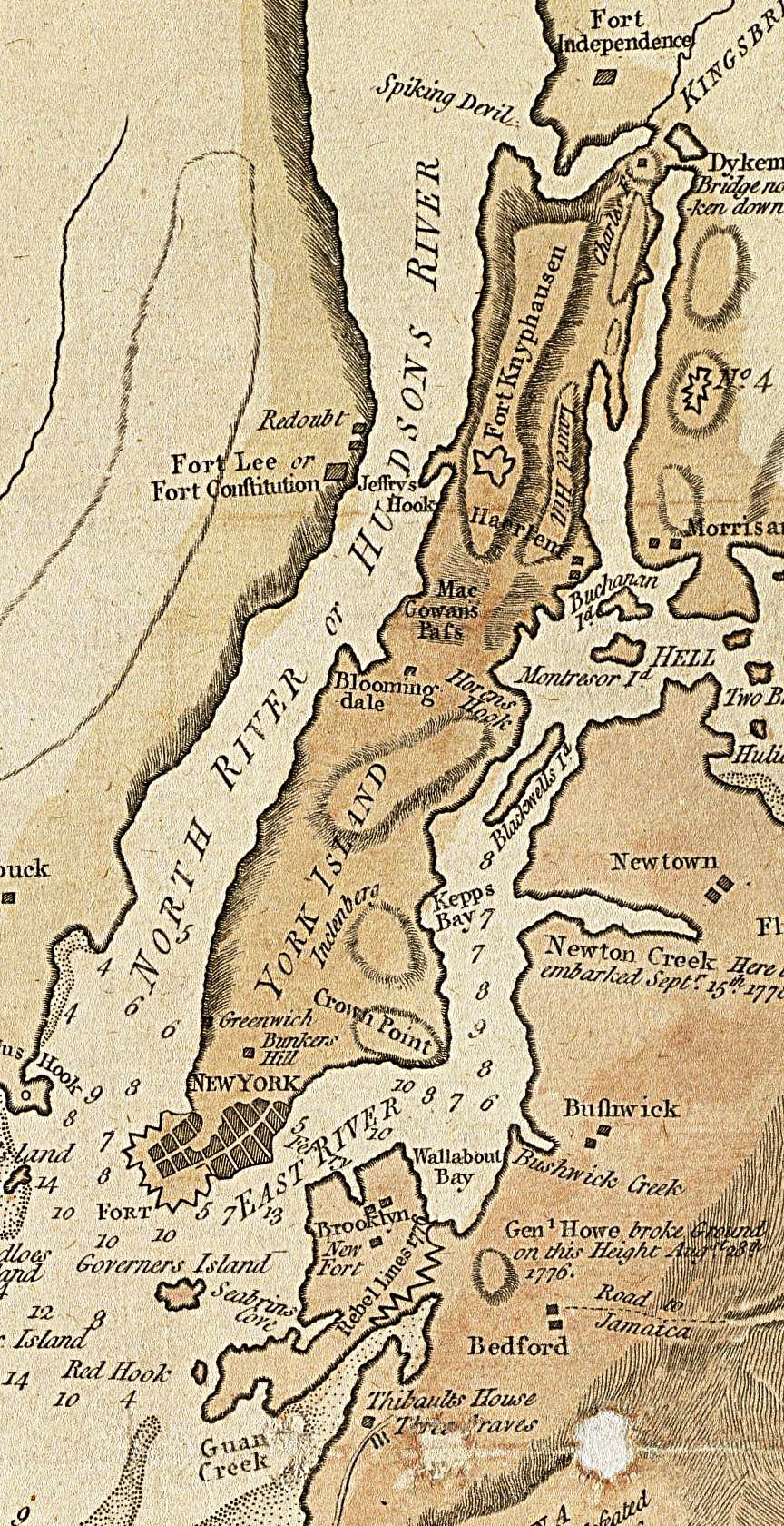
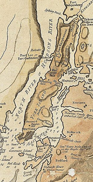
Manhattan1781.jpg
Size of this preview:
308 × 599 pixels
.
Other resolutions:
123 × 240 pixels
|
247 × 480 pixels
|
864 × 1,680 pixels
.
| Description |
English:
A section of a 1781 British map and nautical chart of New York and its harbor. Image has been cropped to show primarily Manhattan, color level adjusted, and sharpened from the original.
|
||||
| Date | |||||
| Source | Norman B. Levinson Map Center, Boston Public Library | ||||
| Author | John Lodge, Publisher: Bew, John | ||||
|
Permission
( Reusing this file ) |
|
||||