Manitou_Islands_Pano_(cropped).jpg

Size of this preview:
800 × 263 pixels
.
Other resolutions:
320 × 105 pixels
|
640 × 211 pixels
|
1,024 × 337 pixels
|
1,280 × 421 pixels
|
5,513 × 1,814 pixels
.
Summary
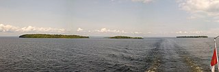
| Description | Manitou Islands Pano |
| Date | Taken on 30 August 2015 |
| Source | https://web.archive.org/web/20161031004321/http://www.panoramio.com/photo/123306656 |
| Author | Paul LaRocque |
|
Permission
( Reusing this file ) |
This file is licensed under the
Creative Commons
Attribution 3.0 Unported
license.
Attribution:
Paul LaRocque
|
| Other versions | |
| Panoramio Tags |
Nipissing, Unorganized, North Part
,
2015
,
Canada
,
Nipissing
,
North Bay
,
Ontario
|
| Camera location |
|
View this and other nearby images on: OpenStreetMap |
|
|---|
.jpg¶ms=046.238132_N_-079.626549_E_globe:Earth_type:camera_source:Panoramio_&language=en)