|
Description
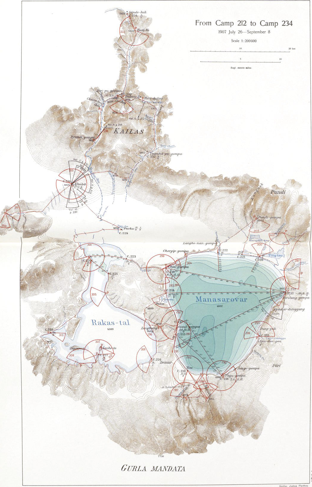
Mansarovar map.jpg
|
Map of the Lake Manasarovar region
|
|
Date
|
between 1915 and 1922
date QS:P,+1950-00-00T00:00:00Z/7,P1319,+1915-00-00T00:00:00Z/9,P1326,+1922-00-00T00:00:00Z/9
|
|
Source
|
Southern Tibet. Discoveries in former times compared with my own researches in 1906-1908. Volume 12
|
|
Creator
|
Sven Hedin
|
Permission
(
Reusing this file
)
|
|
Public domain
Public domain
false
false
|

|

Public domain works must be out of copyright in both the United States and in the source country of the work in order to be hosted on the Commons. If the work is not a U.S. work, the file
must
have an additional
copyright tag
indicating the copyright status in the source country.
Note:
This tag should
not
be used for sound recordings.
PD-1923
Public domain
in the United States
//commons.wikimedia.org/wiki/File:Mansarovar_map.jpg
|
|
|
Geotemporal data
|
|
Bounding box
|
|
N: 31.3063381°N
|
|
W: 80.9677325°E
|

|
E: 81.7646523°E
|
|
S: 30.3272967°N
|
|
|
Georeferencing
|
View the georeferenced map in the Wikimaps Warper
|
|
Other versions
|

|
This file has multiple
extracted images
:
|
|
.jpg)
.jpg)