Manteno_civilisation_map.jpg
Size of this preview:
560 × 599 pixels
.
Other resolutions:
224 × 240 pixels
|
598 × 640 pixels
.
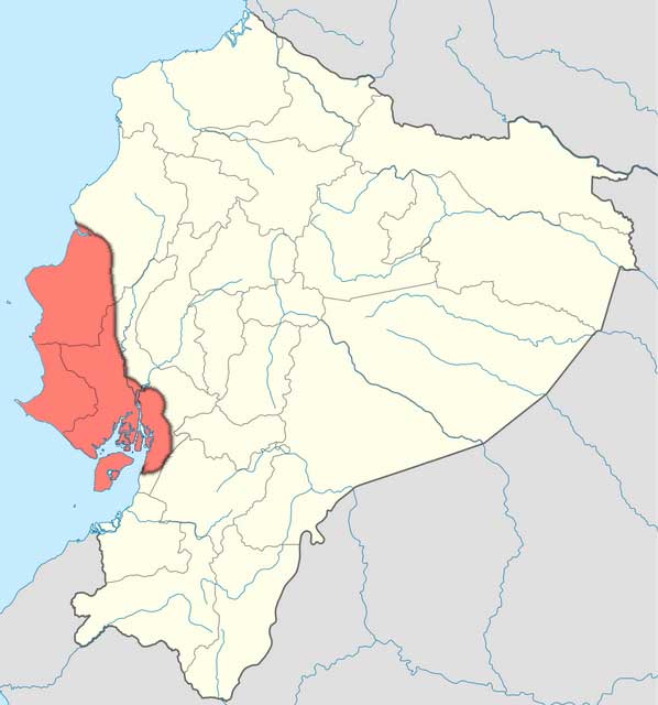
| Description | Map of the en:Manteño civilisation in Ecuador. Overlaid on the original map using the text source Peregrine, P. N., et al. (2001) Encyclopedia of Prehistory: Middle America , 5, p. 307 Retrieved on 28 March 2010. . In particular, the eastern boundary is uncertain, with most settlement on the coast. |
| Date | (UTC) |
| Source | |
| Author |
|
I, the copyright holder of this work, hereby publish it under the following license:

|
Permission is granted to copy, distribute and/or modify this document under the terms of the GNU Free Documentation License , Version 1.2 only as published by the Free Software Foundation ; with no Invariant Sections, no Front-Cover Texts, and no Back-Cover Texts. A copy of the license is included in the section entitled GNU Free Documentation License . | 1.2 only |
Original upload log
This image is a derivative work of the following images:
-
File:Ecuador_location_map.svg
licensed with GFDL-1.2
- 2008-12-09T21:09:07Z NordNordWest 1536x1654 (422346 Bytes) {{Information |Description= {{de|Positionskarte von [[:de:Ecuador|Ecuador]]}} Quadratische Plattkarte. Geographische Begrenzung der Karte: * N: 1.7° N * S: 5.3° S * W: 81.5° W * O: 75.0° W {{en|Location map of [[:en:Ecuad
Uploaded with derivativeFX