Map_Algeria_1929_-_Touring_Club_Italiano_CART-TRC-09.jpg

Size of this preview:
788 × 600 pixels
.
Other resolutions:
315 × 240 pixels
|
631 × 480 pixels
|
1,009 × 768 pixels
|
1,280 × 975 pixels
|
2,560 × 1,949 pixels
|
6,461 × 4,919 pixels
.
Summary
| Title |
Algeria
|
||||||||||||||||
| Description |
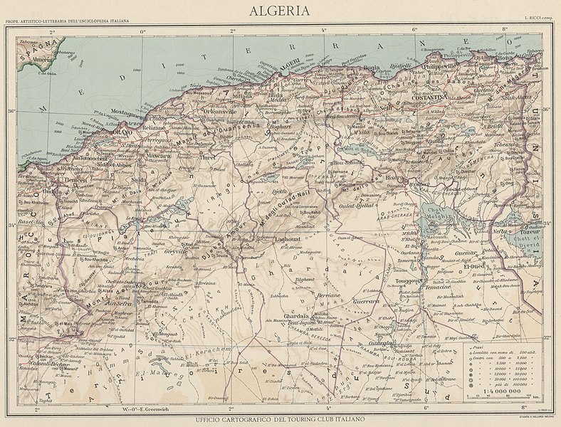
English:
The map shows the physical and political elements of Algeria. The country was a French colony in the late Twenties, when the map was realized. The map is one of the tables made by the TCI Cartographic Office for the Italian Encyclopedia of Giovanni Treccani Institute
Italiano:
La carta riporta gli elementi fisici e politici dell'Algeria, che sul finire degli anni Venti, ai tempi di realizzazione della carta, era una colonia francese. La mappa è una delle tavole realizzate dall'Ufficio Cartografico del TCI per l'Enciclopedia Italiana dell'Istituto Giovanni Treccani
|
||||||||||||||||
| Date | |||||||||||||||||
| Source | Scan from the original work Archivio Storico del Touring Club Italiano | ||||||||||||||||
| Creator |
|
||||||||||||||||
|
Permission
( Reusing this file ) |
|
||||||||||||||||
| Geotemporal data | |||||||||||||||||
| Map location | Algeria | ||||||||||||||||
| Map type | Maps by country - Maps of Algeria | ||||||||||||||||
| Scale | 1: 4 000 000 | ||||||||||||||||
| Georeferencing | If inappropriate please set warp_status = skip to hide. | ||||||||||||||||
| Bibliographic data | |||||||||||||||||
| Part of the series | 1° Edition Italian Encyclopedia Giovanni Treccani | ||||||||||||||||
| Language | Italian | ||||||||||||||||
| Place of publication | Milan | ||||||||||||||||
| Publisher |
TCI
|
||||||||||||||||
| Printed by |
Vallardi
|
||||||||||||||||
| Archival data | |||||||||||||||||
| Collection | |||||||||||||||||
| Accession number |
CART.TRC.09
|
||||||||||||||||
