Map_Languages_CH.png

Size of this preview:
800 × 483 pixels
.
Other resolutions:
320 × 193 pixels
|
640 × 386 pixels
|
1,024 × 618 pixels
|
1,500 × 905 pixels
.
Summary
| Description |
English:
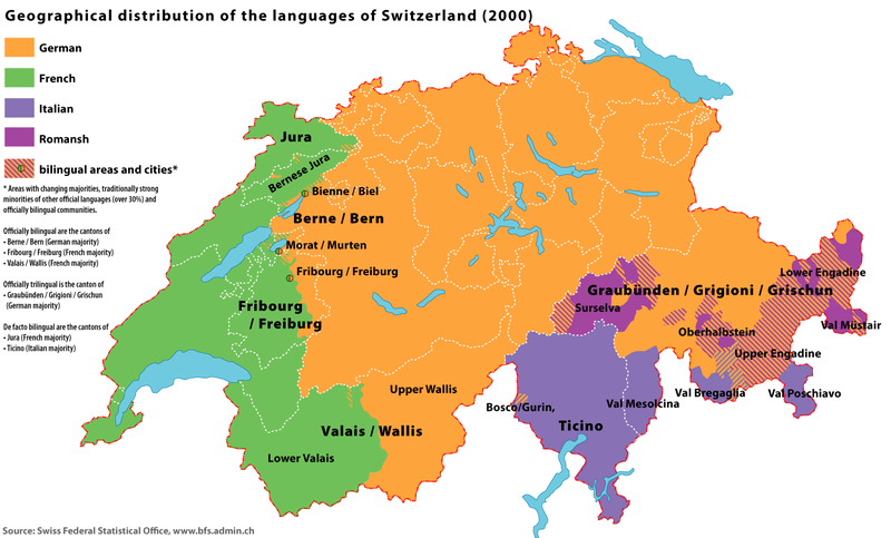
Map of the geographical distribution of the official languages of Switzerland (2000)
|
| Date | |
| Source | Swiss Federal Statistical Office ; census of 2000 |
| Author | Marco Zanoli ( sidonius 13:20, 18 June 2006 (UTC)) |
| Other versions |
|


|
File:Sprachen CH 2000 EN.svg
is a vector version of this file. It should be used in place of this PNG file when not inferior.
File:Map Languages CH.png →
File:Sprachen CH 2000 EN.svg
For more information, see
Help:SVG
.
|

|
Licensing
|
You may use my work outside wikipedia for free as long as you name me as the author. If you would like to use my work in a print medium, please send me a specimen copy.
Contact me if you have questions regarding the license or if you want individual changes to the map (marco.zanoli at hotmail.ch).
This file is licensed under the
Creative Commons
Attribution-Share Alike 4.0 International
license.
Attribution:
Marco Zanoli
|