Map_of_2019_Dayton_Shooting.svg

Size of this PNG preview of this SVG file:
148 × 107 pixels
.
Other resolutions:
320 × 231 pixels
|
640 × 463 pixels
|
1,024 × 740 pixels
|
1,280 × 925 pixels
|
2,560 × 1,851 pixels
.
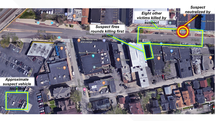
Summary
| Description |
English:
Map showing the timeline of events of the
2019 Dayton shooting
. Based on official police map.
|
| Source | Incorporating elements of Dayton police map . |
| Author | Nice4What , Kjmoran |

Licensing
|
|
This work has been released into the
public domain
by its author,
Nice4What
at
English Wikipedia
. This applies worldwide.
In some countries this may not be legally possible; if so: Nice4What grants anyone the right to use this work for any purpose , without any conditions, unless such conditions are required by law. |