Map_of_Antiparos.jpg
Size of this preview:
594 × 599 pixels
.
Other resolutions:
238 × 240 pixels
|
476 × 480 pixels
|
896 × 904 pixels
.
| Description |
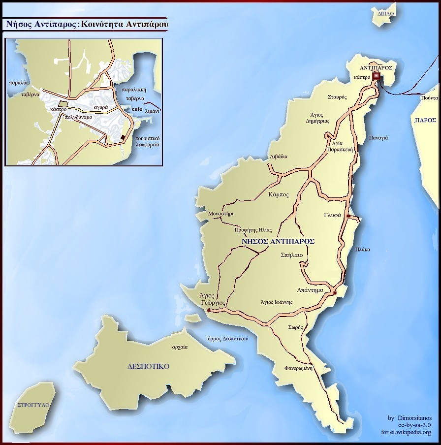
English:
Map of Antiparos island, Greece
Ελληνικά:
Το παρόν απεικονίζει τη Νήσο Αντιπάρου και την ομώνυμη Κοινότητα.
|
| Date | |
| Source | Σύνθεση με Photostudio της Arcsoft. |
| Author | Dimorsitanos |
|
Permission
( Reusing this file ) |
Creative Commons Attribution Sharealike. |
Licensing
This file is licensed under the
Creative Commons
Attribution-Share Alike 3.0 Greece
license.
-
You are free:
- to share – to copy, distribute and transmit the work
- to remix – to adapt the work
-
Under the following conditions:
- attribution – You must give appropriate credit, provide a link to the license, and indicate if changes were made. You may do so in any reasonable manner, but not in any way that suggests the licensor endorses you or your use.
- share alike – If you remix, transform, or build upon the material, you must distribute your contributions under the same or compatible license as the original.

Original upload log
Transferred from el.wikipedia to Commons by MARKELLOS using CommonsHelper .
The original description page was
here
. All following user names refer to el.wikipedia.
- 2007-11-26 23:55 Dimorsitanos 896×904× (160031 bytes) {{Πληροφορίες εικόνας |Περιγραφή=Το παρόν απεικονίζει τη Νήσο Αντιπάρου και την ομώνυμη Κοινότητα. |Πηγή=Σύνθεση με Photostudio της Arcsoft. |Ημερομη�