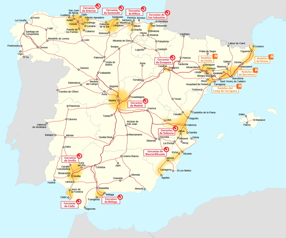
Map_of_Cercania_systems_in_Spain.png

Size of this preview:
720 × 599 pixels
.
Other resolutions:
288 × 240 pixels
|
577 × 480 pixels
|
923 × 768 pixels
|
1,231 × 1,024 pixels
|
1,645 × 1,369 pixels
.
| Description |
|
| Date | see file history |
| Source | Own work |
| Author | Maximilian Dörrbecker ( Chumwa ), using this map by Manchego |
|
Permission
( Reusing this file ) |
I, the copyright holder of this work, hereby publish it under the following license:
This file is licensed under the
Creative Commons
Attribution-Share Alike 2.5 Generic
license.
Sie dürfen das Bild zu den folgenden Bedingungen nutzen:
|