Map_of_Corregidor_1941.jpg
Size of this preview:
800 × 481 pixels
.
Other resolutions:
320 × 192 pixels
|
640 × 384 pixels
|
1,024 × 615 pixels
|
1,280 × 769 pixels
|
2,066 × 1,241 pixels
.
This image was
uploaded
in the
JPEG
format even though it
consists of non-photographic data
. This information could be stored more efficiently or accurately in the
PNG
or
SVG
format.
If possible, please upload a PNG or SVG version of this image without
compression artifacts
, derived from a non-JPEG source (or with existing artifacts
removed
). After doing so, please tag the JPEG version with
{{Superseded|NewImage.ext}}
and remove this tag. This tag should not be applied to photographs or scans. If this image is a diagram or other image suitable for
vectorisation
, please tag this image with
{{Convert to SVG}}
instead of
{{BadJPEG}}
. If not suitable for vectorisation, use
{{Convert to PNG}}
. For more information, see
{{BadJPEG}}
.
|
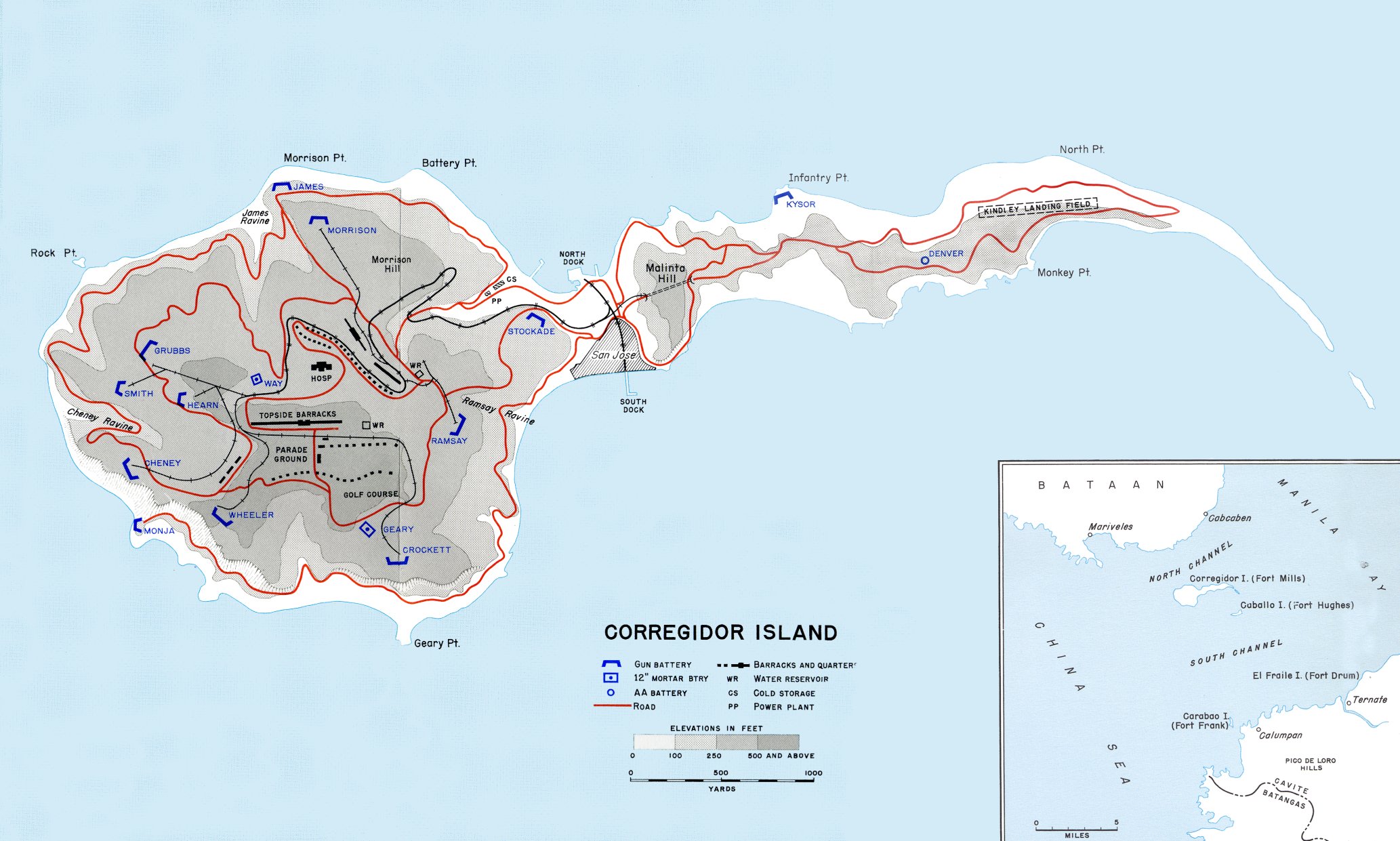
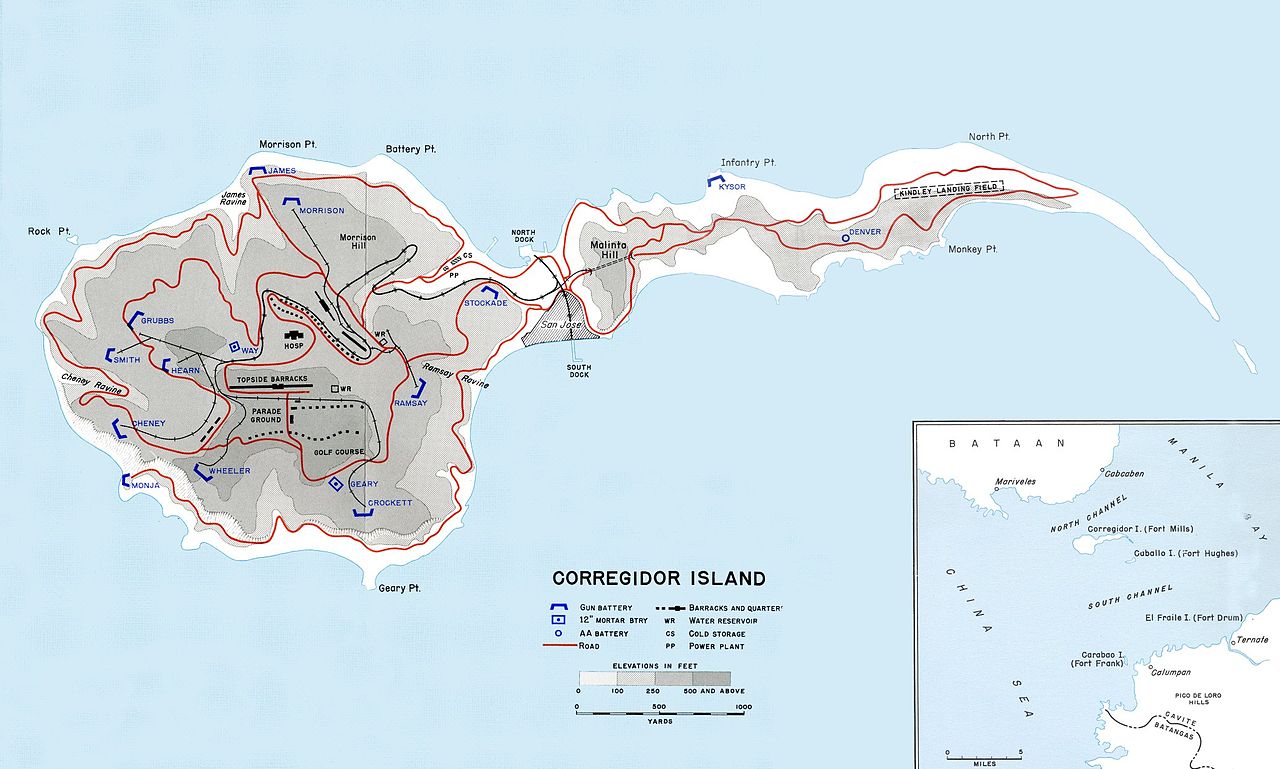
Map of Corregidor island in 1941.
Public domain Public domain false false |
This file is a work of a
U.S. Army
soldier or employee, taken or made as part of that person's official duties. As a
work
of the
U.S. federal government
, it is in the
public domain
in the United States.
العربية ∙ বাংলা ∙ català ∙ čeština ∙ Deutsch ∙ English ∙ español ∙ eesti ∙ فارسی ∙ suomi ∙ français ∙ hrvatski ∙ magyar ∙ Bahasa Indonesia ∙ italiano ∙ 日本語 ∙ 한국어 ∙ lietuvių ∙ македонски ∙ മലയാളം ∙ မြန်မာဘာသာ ∙ Nederlands ∙ polski ∙ português ∙ русский ∙ sicilianu ∙ српски / srpski ∙ Türkçe ∙ українська ∙ Tiếng Việt ∙ 中文(简体) ∙ 中文(繁體) ∙ +/− |