Map_of_Malta_2.png
Size of this preview:
531 × 599 pixels
.
Other resolutions:
213 × 240 pixels
|
425 × 480 pixels
|
987 × 1,114 pixels
.

|
This map has been uploaded by
Electionworld
from en.wikipedia.org to enable the
|
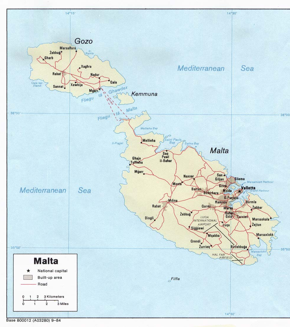
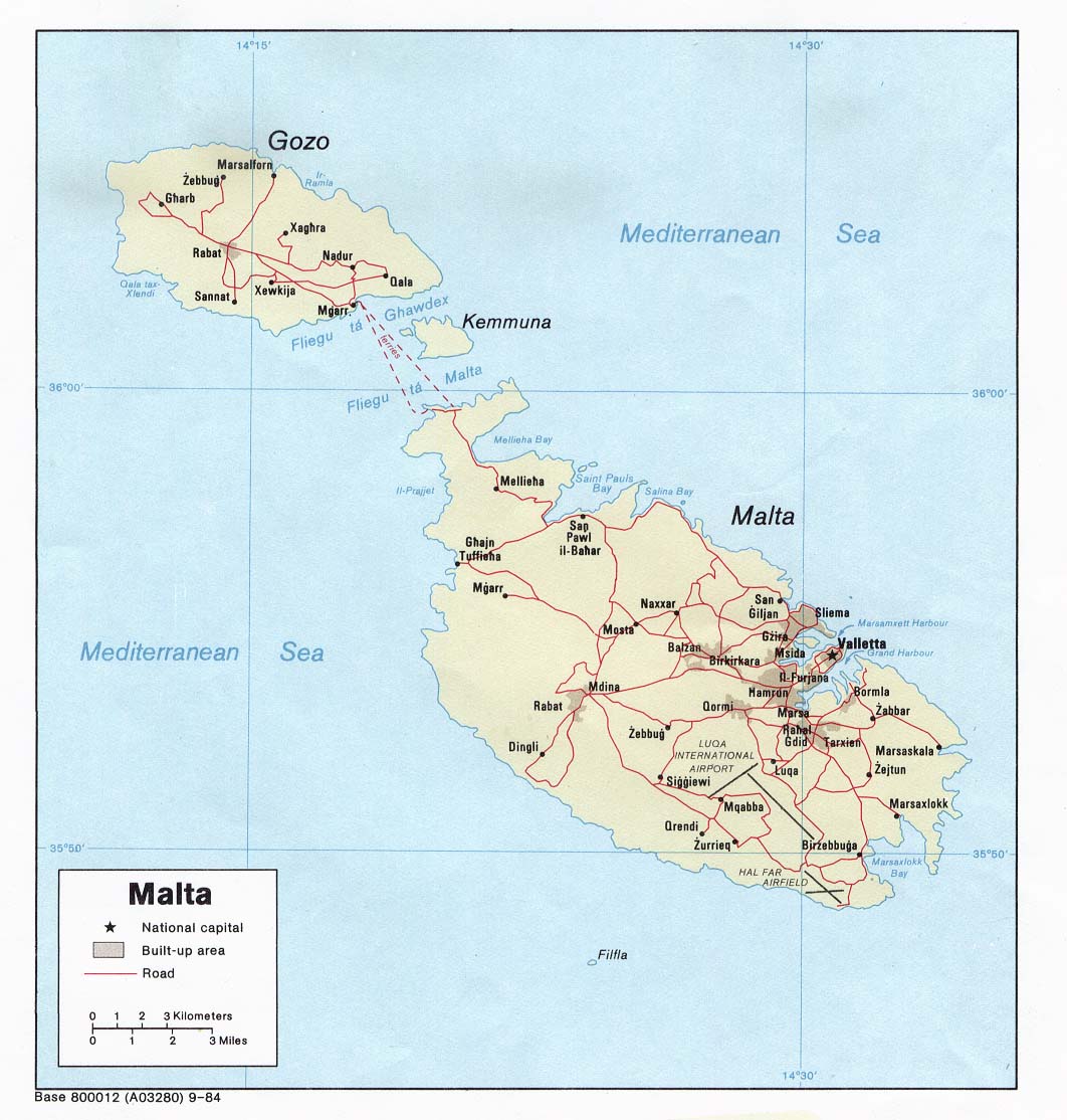
Political map of Malta . Created in 1984 by the Central Intelligence Agency .
|
|
This image is in the
public domain
because it contains materials that originally came from the United States
Central Intelligence Agency
's
World Factbook
.
|

|
http://www.lib.utexas.edu/maps/europe.html
http://www.lib.utexas.edu/maps/europe/malta_pol84.jpg