Map_of_Middlesex.jpg

Summary
| Description |
English:
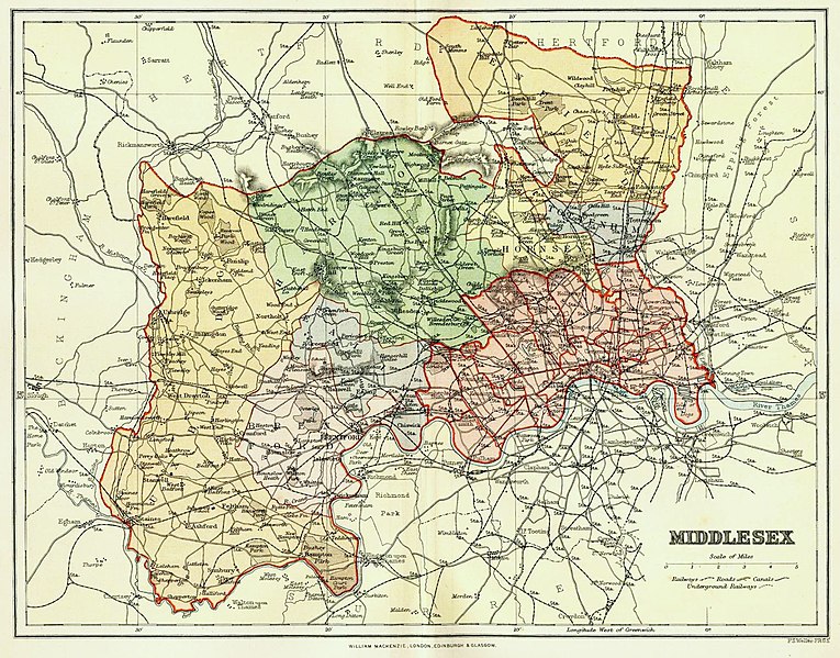
Colour engraving of a map of the County of Middlesex, England, by F. S. Weller published by William Mackenzie in
The Comprehensive Gazetteer of England and Wales
, circa 1891-95. Includes areas transferred to new County of London in 1889 and areas that remained part of the administrative county until its abolition in 1965.
|
| Date | circa 1891-1895 |
| Source | http://www.middx.net ; published by William Mackenzie |
| Author | Engraved by F. S. Weller (1849-1910) |
Licensing
|
This image is in the
public domain
because it is a mere mechanical scan or photocopy of a public domain original, or – from the available evidence – is so similar to such a scan or photocopy that no copyright protection can be expected to arise. The original itself is in the public domain for the following reason:
This tag is designed for use where there may be a need to assert that any enhancements (eg brightness, contrast, colour-matching, sharpening) are in themselves insufficiently creative to generate a new copyright. It can be used where it is unknown whether any enhancements have been made, as well as when the enhancements are clear but insufficient. For known raw unenhanced scans you can use an appropriate {{PD-old}} tag instead. For usage, see Commons:When to use the PD-scan tag . 
|
||||
Original upload log
- 2015-07-30 19:36 AlasdairDaw 1524×1194× (532816 bytes) Uploading an excerpt from a non-free work using [[Wikipedia:File_Upload_Wizard|File Upload Wizard]]