Map_of_Swedish_dialects.png
No higher resolution available.

|
This
linguistic map
image could be re-created
using
vector graphics
as an
SVG
file
. This has several advantages; see
Commons:Media for cleanup
for more information. If an SVG form of this image is available, please upload it and afterwards replace this template with
{{

vector version available

|

new image name

}}
.
It is recommended to name the SVG file “Map of Swedish dialects.svg”—then the template Vector version available (or Vva ) does not need the new image name parameter. |
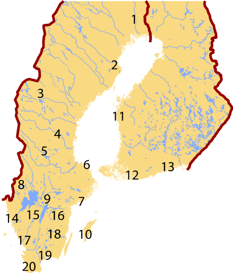
| Description | Map of Swedish dialects. Maps of Sweden and Finland adapted from [1] and [2] , the International Nuclear Safety Center at Argonne National Laboratory. |
| Date | |
| Source | Own work |
| Author | Jeffrey Connell ( IceKarma ) |
|
Permission
( Reusing this file ) |
Derived from public domain images from the Department of Energy. See [3] . |
See Swedish language#Dialects for index.
|
|
This image is a work of a
United States Department of Energy
(or predecessor organization) employee, taken or made as part of that person's official duties. As a
work
of the
U.S. federal government
, the image is in the
public domain
.
Please note that national laboratories operate under varying licences and some are not free . Check the site policies of any national lab before crediting it with this tag.
|

|