Map_of_fictional_Winesburg,_Ohio.jpg
Size of this preview:
427 × 599 pixels
.
Other resolutions:
171 × 240 pixels
|
342 × 480 pixels
|
548 × 768 pixels
|
1,233 × 1,729 pixels
.
Summary
| Description |
English:
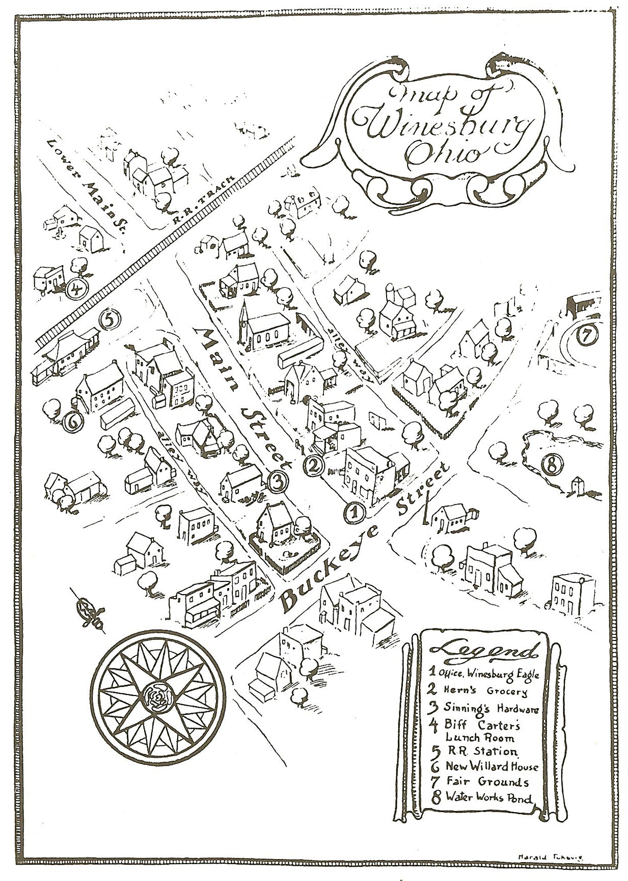
Map of the town Winesburg, Ohio from the first edition of Sherwood Anderson's book of the same name.
|
| Date | |
| Source | Anderson, Sherwood. Winesburg, Ohio. New York: B.W. Huebsch, 1919. |
| Author | Harold Toksvig |
This image is scanned from Winesburg, Ohio: A Norton Critical Edition. Edited by Charles E. Modlin and Ray Lewis White. New York: W.W. Norton, 1996. It is a facsimile of the original which was published in 1919 and therefore no longer protected by copyright.
Licensing
|
|
This media file is in the
public domain
in the
United States
. This applies to U.S. works where the copyright has expired, often because its first
publication
occurred prior to January 1, 1929, and if not then due to lack of notice or renewal. See
this page
for further explanation.
|

|

|
This image might not be in the public domain outside of the United States; this especially applies in the countries and areas that do not apply the
rule of the shorter term
for US works, such as Canada, Mainland China (not Hong Kong or Macao), Germany, Mexico, and Switzerland. The creator and year of publication are essential information and must be provided. See
Wikipedia:Public domain
and
Wikipedia:Copyrights
for more details.
|