Map_of_the_Kiel_Canal_and_Eiderkanal.png
Size of this preview:
773 × 600 pixels
.
Other resolutions:
310 × 240 pixels
|
619 × 480 pixels
|
990 × 768 pixels
|
1,280 × 993 pixels
|
1,814 × 1,407 pixels
.
Summary
| Description |
English:
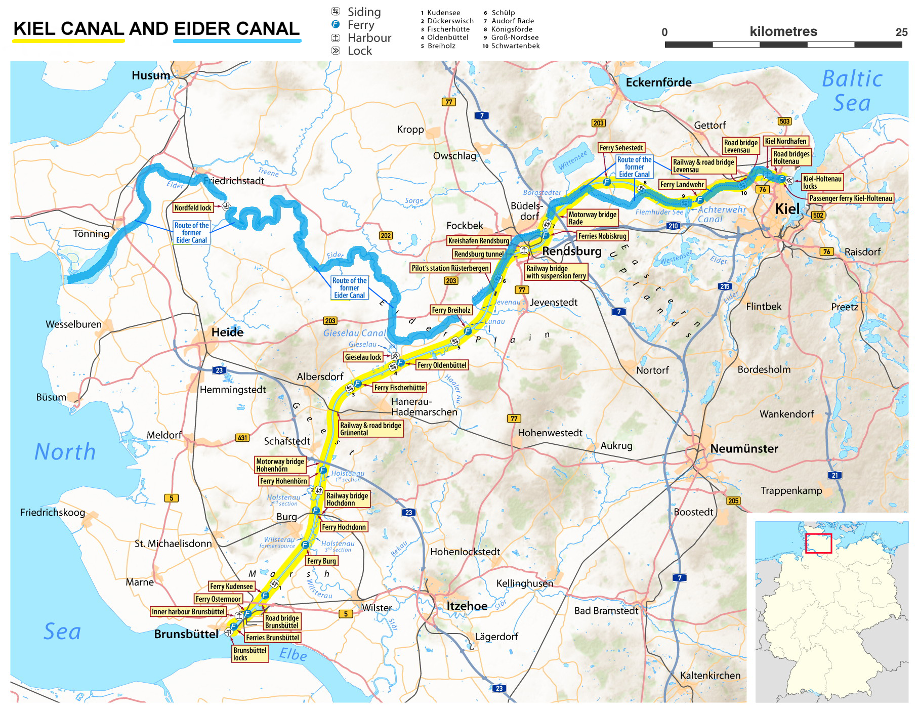
Map of the Kiel Canal (yellow) and the Eider Canal (blue)
|
| Date | |
| Source | http://en.wikipedia.org/wiki/File:Map_of_the_Kiel_Canal.png |
| Author | OpenStreetMap data for the background Maximilian Dörrbecker (Kiel Canal) and user:Holger.Ellgaard (Eider Canal) |
| Other versions |
|


Licensing
This file is licensed under the
Creative Commons
Attribution-Share Alike 2.0 Generic
license.
-
You are free:
- to share – to copy, distribute and transmit the work
- to remix – to adapt the work
-
Under the following conditions:
- attribution – You must give appropriate credit, provide a link to the license, and indicate if changes were made. You may do so in any reasonable manner, but not in any way that suggests the licensor endorses you or your use.
- share alike – If you remix, transform, or build upon the material, you must distribute your contributions under the same or compatible license as the original.