Map_of_the_northern_parts_of_the_United_States_of_America_(1804).jpg
Size of this preview:
800 × 562 pixels
.
Other resolutions:
320 × 225 pixels
|
640 × 450 pixels
|
1,024 × 720 pixels
|
1,280 × 900 pixels
|
2,560 × 1,800 pixels
|
5,530 × 3,888 pixels
.
Summary
| Description |
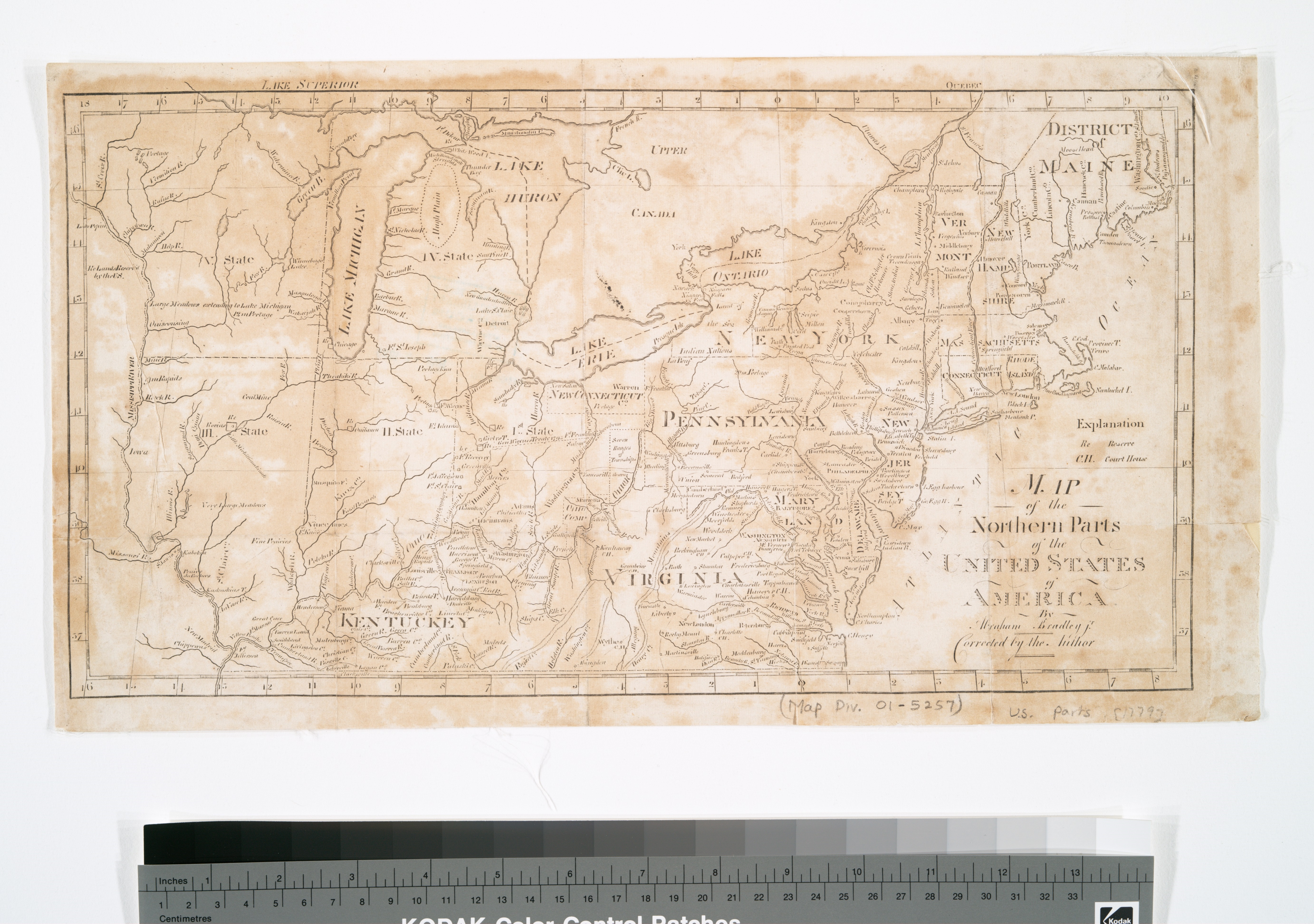
English:
An 1804 map of States north of Virginia and Kentucky, to include the Northwest Territories
|
| Date | |
| Source | Lionel Pincus and Princess Firyal Map Division, The New York Public Library. "Map of the northern parts of the United States of America" New York Public Library Digital Collections. Accessed January 13, 2016. https://digitalcollections.nypl.org/items/510d47da-ee72-a3d9-e040-e00a18064a99 |
| Author |
Etheridge, Samuel (1771-1817 ) (Printer) Thomas & Andrews (Publisher)Bradley, Abraham (d. 1838) (Cartographer) |
Licensing
|
|
This media file is in the
public domain
in the
United States
. This applies to U.S. works where the copyright has expired, often because its first
publication
occurred prior to January 1, 1929, and if not then due to lack of notice or renewal. See
this page
for further explanation.
|

|

|
This image might not be in the public domain outside of the United States; this especially applies in the countries and areas that do not apply the
rule of the shorter term
for US works, such as Canada, Mainland China (not Hong Kong or Macao), Germany, Mexico, and Switzerland. The creator and year of publication are essential information and must be provided. See
Wikipedia:Public domain
and
Wikipedia:Copyrights
for more details.
|