Map_of_the_world_by_the_US_Gov_as_of_2016.svg

Size of this PNG preview of this SVG file:
800 × 434 pixels
.
Other resolutions:
320 × 174 pixels
|
640 × 347 pixels
|
1,024 × 555 pixels
|
1,280 × 694 pixels
|
2,560 × 1,389 pixels
|
3,464 × 1,879 pixels
.
Summary
| Description |
English:
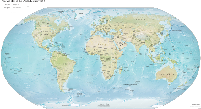
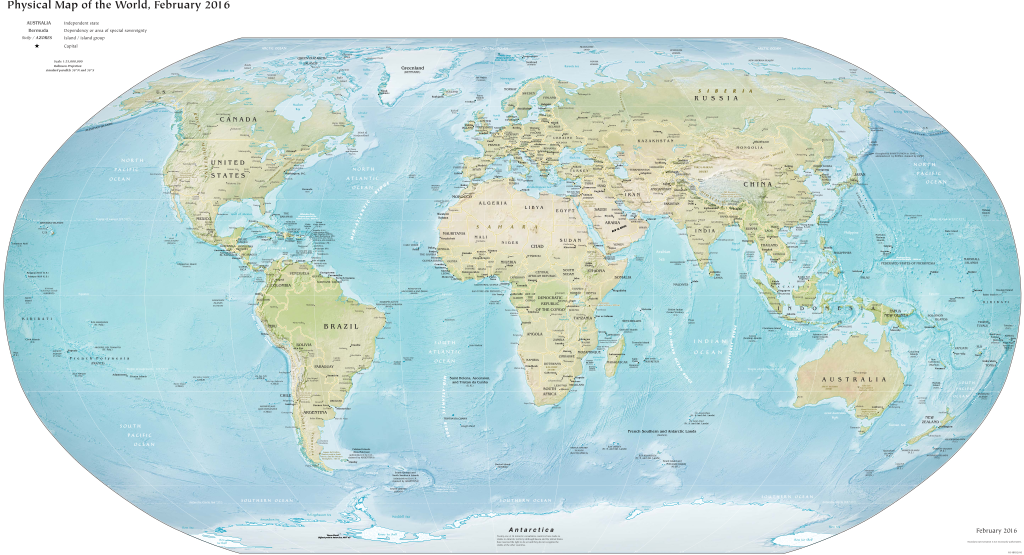
Map of the world as released by the United States Government, February 2016. Robinson projection, standard parallels 38°N and 38°S.
English:
Carte du monde realisee par le Gouvernement des Etats-Unis en 2016
|
| Date | |
| Source | CIA World Factbook |
| Author | US Government, Central Intelligence Agency |
| Other versions |
|
Licensing
|
|
This work is in the
public domain
in the United States because it is a
work prepared by an officer or employee of the United States Government as part of that person’s official duties
under the terms of
Title 17, Chapter 1, Section 105
of the
US Code
.
Note
: This only applies to original works of the Federal Government and not to the work of any individual
U.S. state
,
territory
, commonwealth, county, municipality, or any other subdivision. This template also does not apply to postage stamp designs published by the
United States Postal Service
since 1978
. (See §
313.6(C)(1)
of Compendium of U.S. Copyright Office Practices). It also does not apply to certain US coins; see
The US Mint Terms of Use
.
|

|
| This file has been identified as being free of known restrictions under copyright law, including all related and neighboring rights. | ||