Map_roman_cities_in_Greece-fr.svg

Size of this PNG preview of this SVG file:
530 × 599 pixels
.
Other resolutions:
212 × 240 pixels
|
424 × 480 pixels
|
679 × 768 pixels
|
905 × 1,024 pixels
|
1,811 × 2,048 pixels
|
702 × 794 pixels
.
Summary
| Description |
English:
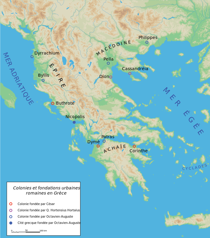
Map of cities founded by the Romans in ancient Greece.
Français :
Carte des villes fondées par les Romain en Grèce antique.
|
||||||||
| Date | |||||||||
| Source | Création personnelle avec Adobe Illustrator (d'après M. Sève, « Colonies et fondations urbaines dans la Grèce romaine », dans J.-L. Huot (éd.), La Ville neuve, une idée de l'Antiquité ? , Paris, 1988, p. 185-201.). | ||||||||
| Author | Marsyas | ||||||||
|
Permission
( Reusing this file ) |
I, the copyright holder of this work, hereby publish it under the following licenses:
This file is licensed under the
Creative Commons
Attribution-Share Alike 2.5 Generic
license.
You may select the license of your choice.
|
||||||||
| Other versions |
[
]
|


|
This SVG file contains embedded text that can be translated into your language, using any capable SVG editor, text editor or the SVG Translate tool . For more information see: About translating SVG files . |