Mapa_politico_de_Venezuela_1840_restored_version.jpg

Size of this preview:
800 × 556 pixels
.
Other resolutions:
320 × 222 pixels
|
640 × 444 pixels
|
1,024 × 711 pixels
|
1,280 × 889 pixels
|
2,560 × 1,778 pixels
|
6,161 × 4,279 pixels
.
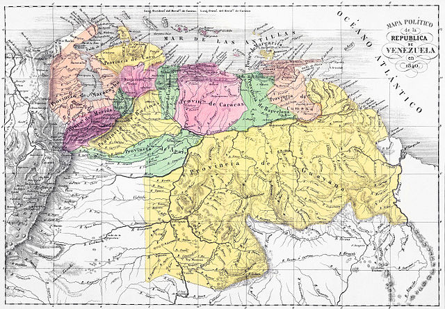
Summary
| Description |
English:
Political map of the Republic of Venezuela in 1840. Lith. de Thierry freres a Paris. (Caracas 1840). Size: 57x40cm. Two lithographed maps. Full hand col. Relief shown by hachures.
|
||||||||||||||||||||
| Date | |||||||||||||||||||||
| Source | Phillips, 2775. Phillips. Maps of America, p. 962. Catalogue of maps of Hispanic America, v. 3, p. 29. [1] | ||||||||||||||||||||
| Author |
|
||||||||||||||||||||
| Other versions |
|
||||||||||||||||||||


Licensing
|
|
This work is in the public domain in its country of origin and other countries and areas where the copyright term is the author's life plus 100 years or fewer . |
| This file has been identified as being free of known restrictions under copyright law, including all related and neighboring rights. | |