MapofEmergingUSMegaregions.png
Size of this preview:
800 × 533 pixels
.
Other resolutions:
320 × 213 pixels
|
640 × 426 pixels
|
1,024 × 682 pixels
|
1,280 × 853 pixels
|
2,494 × 1,662 pixels
.

|
This
map
image could be re-created
using
vector graphics
as an
SVG
file
. This has several advantages; see
Commons:Media for cleanup
for more information. If an SVG form of this image is available, please upload it and afterwards replace this template with
{{

vector version available

|

new image name

}}
.
It is recommended to name the SVG file “MapofEmergingUSMegaregions.svg”—then the template Vector version available (or Vva ) does not need the new image name parameter. |
| Description |
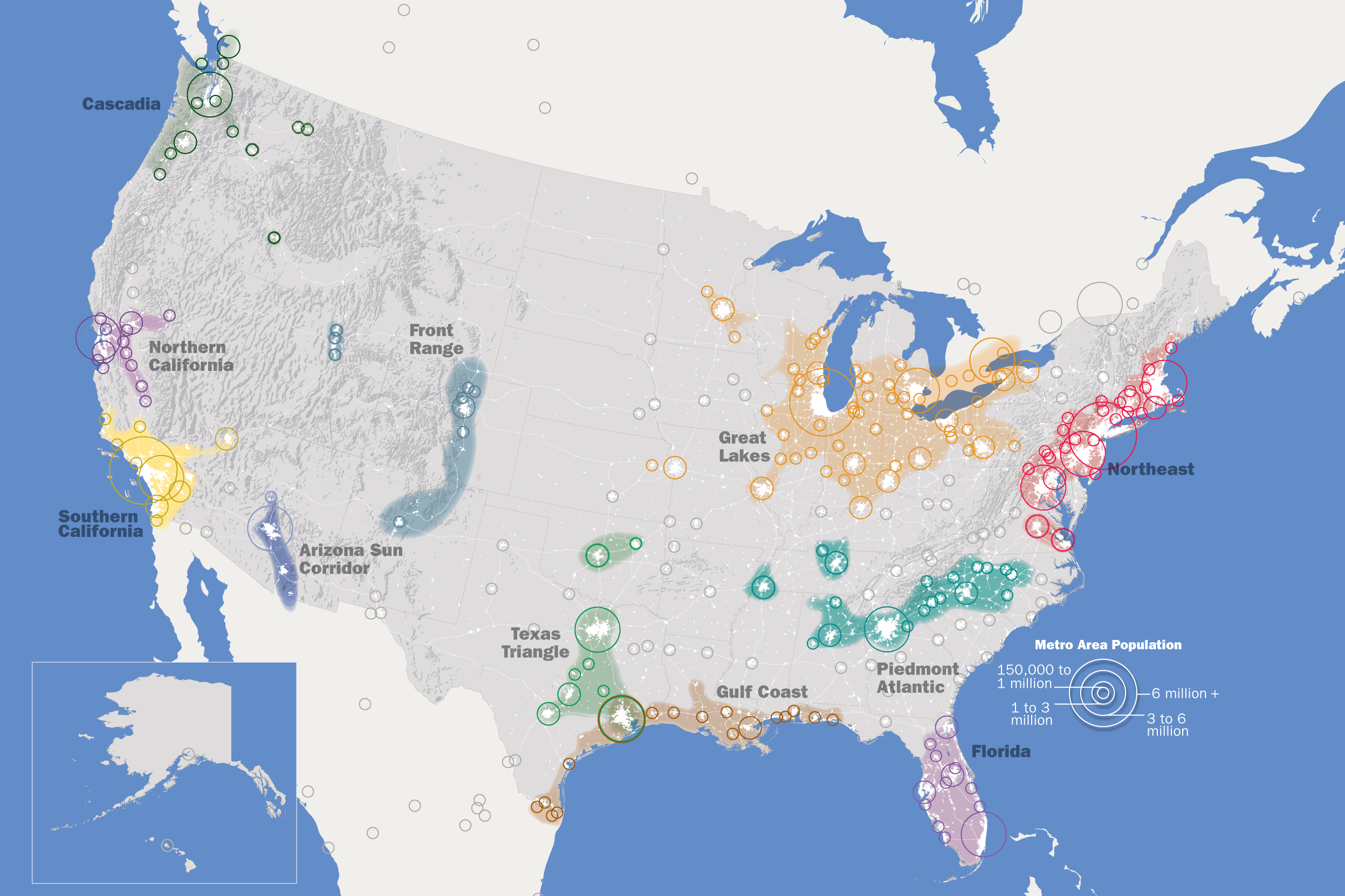
English:
This map, created by the Regional Plan Association, illustrates eleven metropolitan areas that are growing into megaregions.
|
| Date | |
| Source | Own work , https://web.archive.org/web/20130325033001/http://www.rpa.org/america2050/sync/elements/america2050map.png |
| Author | IrvingPlNYC |
|
Permission
( Reusing this file ) |
I, the copyright holder of this work, hereby publish it under the following license:
This file is licensed under the
Creative Commons
Attribution-Share Alike 3.0 Unported
license.
|
| Other versions |
Derivative works of this file: |
| Annotations | This image is annotated: View the annotations at Commons |