Mapofgermancoast-1775.jpg
Size of this preview:
800 × 465 pixels
.
Other resolutions:
320 × 186 pixels
|
640 × 372 pixels
|
1,124 × 653 pixels
.
Summary
| Description |
English:
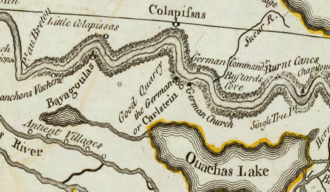
Map of "German Coast" of Louisiana in the 18th century. "Colapissas" marks present day LaPlace, Louisiana.
|
| Date | (original map drawn); 1775 (publication) |
| Source |
Map drawn in 1718 by Guillaume Delisle. French archives.
Transwiki details:
|
| Author | Guillaume Delisle (d. 1726) |
![[1]](https://en.wikipedia.org/wiki/File:Mapofgermancoast-1775.jpg)
Licensing
|
|
This work is in the public domain in its country of origin and other countries and areas where the copyright term is the author's life plus 100 years or fewer . This work is in the public domain in the United States because it was published (or registered with the U.S. Copyright Office ) before January 1, 1929. |
| This file has been identified as being free of known restrictions under copyright law, including all related and neighboring rights. | |