Marine_protected_areas_detailed_map.jpg
Size of this preview:
800 × 486 pixels
.
Other resolutions:
320 × 194 pixels
|
640 × 389 pixels
|
1,024 × 622 pixels
|
1,280 × 777 pixels
|
2,560 × 1,554 pixels
|
4,200 × 2,550 pixels
.
Summary
| Description |
English:
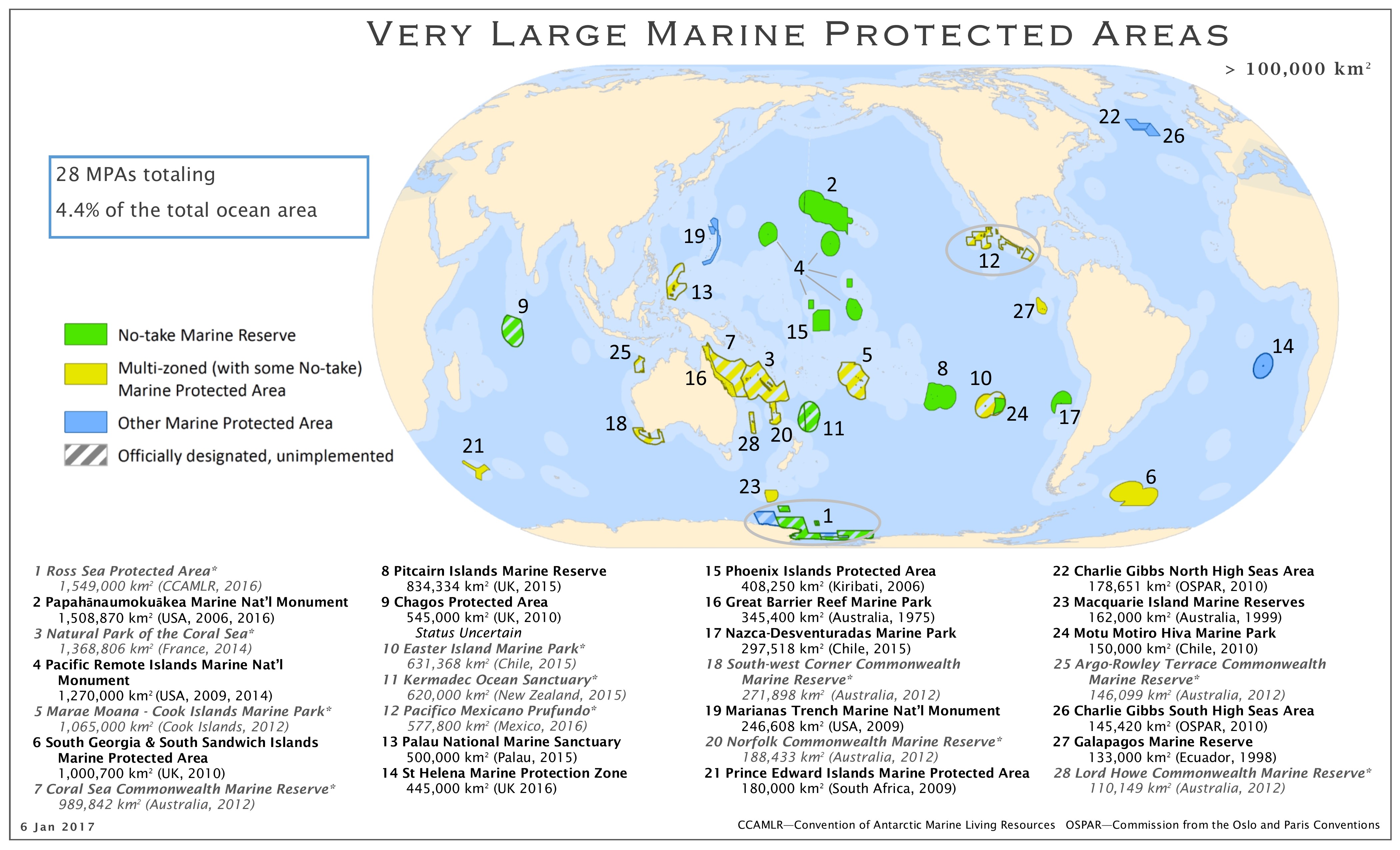
Map of the marine protected areas as of 01/2017
|
| Date | |
| Source | http://imperative-mooc.magnetised.net/monitoring-the-oceans-from-space/week-5-oceans-and-us/topic-5a-policy/marine-protected-areas-detailed-map |
| Author | MPAtlas.org / Marine Conservation Institute |
|
Permission
( Reusing this file ) |
Licensing
This file is licensed under the
Creative Commons
Attribution-Share Alike 4.0 International
license.
-
You are free:
- to share – to copy, distribute and transmit the work
- to remix – to adapt the work
-
Under the following conditions:
- attribution – You must give appropriate credit, provide a link to the license, and indicate if changes were made. You may do so in any reasonable manner, but not in any way that suggests the licensor endorses you or your use.
- share alike – If you remix, transform, or build upon the material, you must distribute your contributions under the same or compatible license as the original.