Mediterranean_at_218_BC-en.svg

Size of this PNG preview of this SVG file:
800 × 475 pixels
.
Other resolutions:
320 × 190 pixels
|
640 × 380 pixels
|
1,024 × 608 pixels
|
1,280 × 759 pixels
|
2,560 × 1,519 pixels
|
2,058 × 1,221 pixels
.
Summary
| Description |
English:
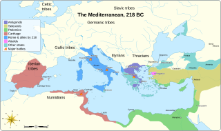
Mediterranean at 218 BC
|
||||||||||||||
| Date | |||||||||||||||
| Source |
Own work based on:
|
||||||||||||||
| Author | Goran tek-en | ||||||||||||||
|
Permission
( Reusing this file ) |
This file is licensed under the
Creative Commons
Attribution-Share Alike 4.0 International
license.
Attribution:
Goran tek-en
|
||||||||||||||
| Other versions |
[
]
|
||||||||||||||
| SVG development |
This
vector image
was created with
Inkscape
.
|
||||||||||||||


| Object location |
|
View this and other nearby images on: OpenStreetMap |
|
|---|

