Mercator_north_pole_1595.jpg
Size of this preview:
635 × 600 pixels
.
Other resolutions:
254 × 240 pixels
|
508 × 480 pixels
|
813 × 768 pixels
|
1,084 × 1,024 pixels
|
1,700 × 1,606 pixels
.
Summary
| Description |
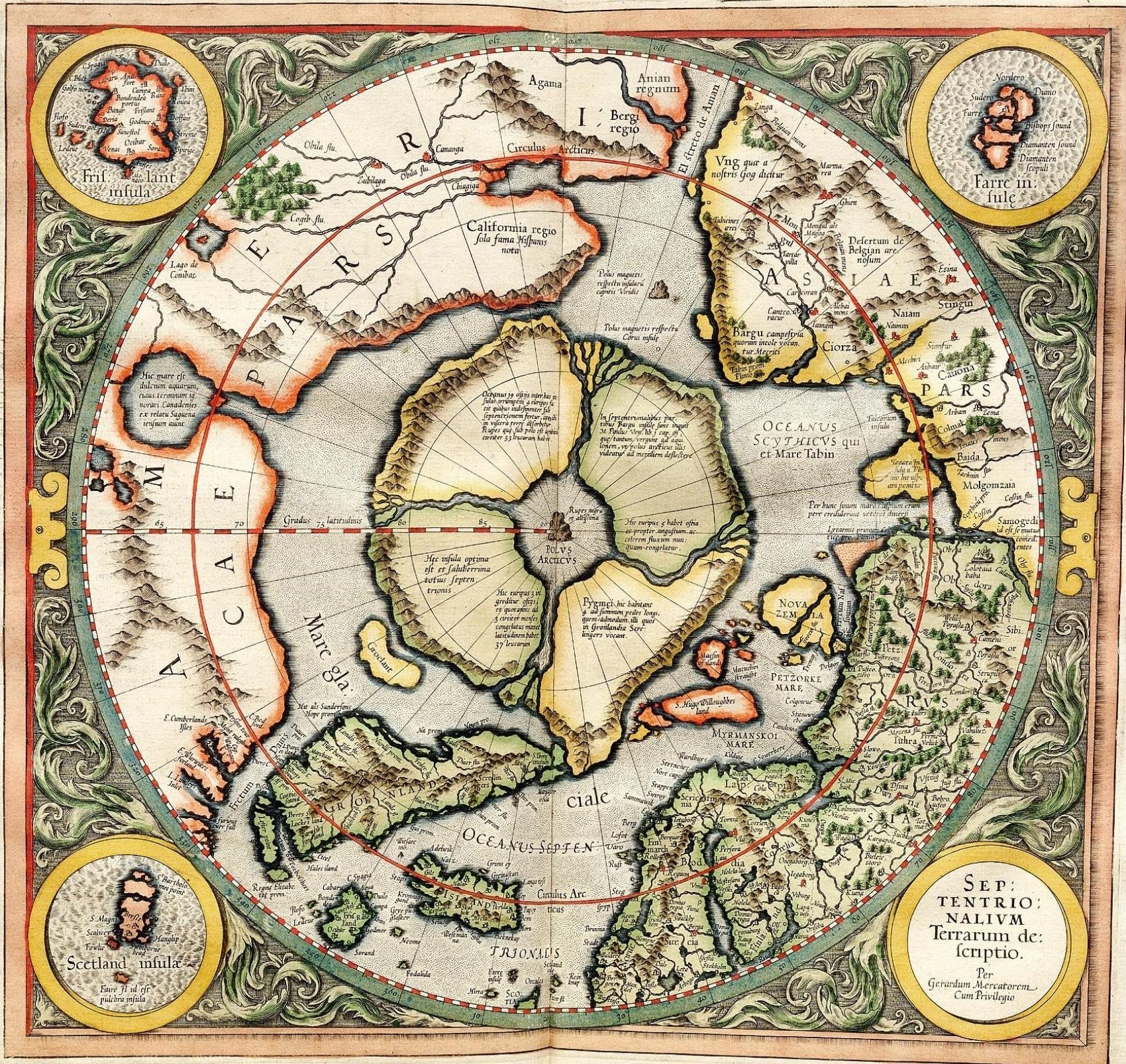
Mercator's 1595 map of the Arctic. Mercator, Gerhard, 1512-1594. "Septentrionalium Terrarum descriptio" [1595]. First state, from his posthumously published atlas, Atlantis pars altera. |
||||||||||||||||||||||||||
| Date | |||||||||||||||||||||||||||
| Source | http://libweb5.princeton.edu/visual_materials/maps/websites/northwest-passage/mercator.htm | ||||||||||||||||||||||||||
| Author |
|
||||||||||||||||||||||||||
|
Permission
( Reusing this file ) |
|
||||||||||||||||||||||||||

Licensing
|
|
This work is in the public domain in its country of origin and other countries and areas where the copyright term is the author's life plus 100 years or fewer . |
| This file has been identified as being free of known restrictions under copyright law, including all related and neighboring rights. | |
_-_Geographicus_-_NorthPole-mercator-1606.jpg)
]